
IMAGES TAKEN NEAR TO
Belvedere Park, BELFAST, BT9 5GT
Introduction
This page details the photographs taken nearby to Belvedere Park, BT9 5GT by members of the Geograph project.
The Geograph project started in 2005 with the aim of publishing, organising and preserving representative images for every square kilometre of Great Britain, Ireland and the Isle of Man.

There are currently over 7.5m images from over14,400 individuals and you can help contribute to the project by visiting https://www.geograph.org.uk
Image Map
Images are licensed for reuse under creativecommons.org/licenses/by-sa/2.0
Notes
- Clicking on the map will re-center to the selected point.
- The higher the marker number, the further away the image location is from the centre of the postcode.
Image Listing (37 Images Found)
Images are licensed for reuse under creativecommons.org/licenses/by-sa/2.0
Image
Details
Distance
1
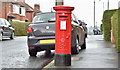
Pillar box BT9 670, Stranmillis, Belfast (April 2016)
EIIR pillar box (BT9 670) at the western end of Cricklewood Park.
Image: © Albert Bridge
Taken: 12 Apr 2016
0.06 miles
2
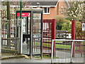
Telephone box, Stranmillis, Belfast (April 2016)
KX100 telephone box, at Cricklewood Park, close to Stranmillis Primary School.
Image: © Albert Bridge
Taken: 12 Apr 2016
0.07 miles
3
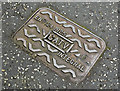
CATV access cover, Stranmillis, Belfast - April 2016(1)
A cable television (CATV) https://en.wikipedia.org/wiki/Cable_television access cover at Cricklewood Park/Willesden Park. No foundry name visible.
Image: © Albert Bridge
Taken: 12 Apr 2016
0.08 miles
4
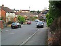
Hillside Gardens, Belfast
Off Hillside Drive - in the Stranmillis area.
Image: © Dean Molyneaux
Taken: 10 Mar 2010
0.15 miles
5
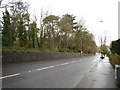
Stranmillis Road, Belfast
Looking down the road in the direction of the river Lagan.
Image: © Rossographer
Taken: 18 Jan 2008
0.17 miles
6
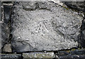
Bench Mark, Belfast
Cut bench mark on a wall along the Stranmillis Road in Belfast.
See also http://www.geograph.org.uk/search.php?i=11037856 for many other examples I have found.
Image: © Rossographer
Taken: 11 Mar 2010
0.18 miles
7
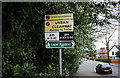
Signs, Stranmillis Road
Two fading signs on the Stranmillis Road in Belfast. The first in a fairly standard Urban Clearway sign (with additional no stopping on footpath warning); the second is a pedestrian sign for the nearby Lagan Meadows http://www.geograph.org.uk/search.php?i=11247890 .
Image: © Rossographer
Taken: 11 Mar 2010
0.18 miles
8
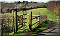
The Lagan Meadows walk, Belfast (24)
See Image One of the wicket gates between the path and the fields. This shows the undulating nature of the path. The view is towards this one Image Ciontinue to Image
Image: © Albert Bridge
Taken: 31 Mar 2010
0.19 miles
9
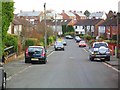
Hillside Park, Belfast
A street of semi-detached houses leading south off Hillside Drive in the Stranmillis area of the city.
Image: © Dean Molyneaux
Taken: 10 Mar 2010
0.19 miles
10
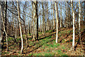
The Lagan Meadows walk, Belfast (25)
Image: © Albert Bridge
Taken: 31 Mar 2010
0.20 miles