
IMAGES TAKEN NEAR TO
Lockview Road, BELFAST, BT9 5FH
Introduction
This page details the photographs taken nearby to Lockview Road, BT9 5FH by members of the Geograph project.
The Geograph project started in 2005 with the aim of publishing, organising and preserving representative images for every square kilometre of Great Britain, Ireland and the Isle of Man.

There are currently over 7.5m images from over14,400 individuals and you can help contribute to the project by visiting https://www.geograph.org.uk
Image Map
Images are licensed for reuse under creativecommons.org/licenses/by-sa/2.0
Notes
- Clicking on the map will re-center to the selected point.
- The higher the marker number, the further away the image location is from the centre of the postcode.
Image Listing (280 Images Found)
Images are licensed for reuse under creativecommons.org/licenses/by-sa/2.0
Image
Details
Distance
1
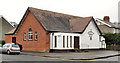
Laganvale gospel hall. Belfast
Gospel hall (last seen in Image - November 2005), on the Lockview Road, at the corner of Harleston Street Image (left). I haven’t been able to discover when the hall was built but it’s possible that the assembly dates from circa 1907 when it met at 181 Ormeau Road as the Ormeau gospel hall. Further information very welcome.
Image: © Albert Bridge
Taken: 8 Mar 2012
0.01 miles
2
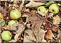
Crab apples, Stranmillis, Belfast (November 2015)
Crab apples on the Lockview Road. They don’t seem to show any significant sign of rot and may be assumed to have fallen during the high winds over the last few days.
Image: © Albert Bridge
Taken: 9 Nov 2015
0.03 miles
3
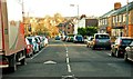
The Lockview Road, Belfast
A mainly residential cul-de-sac running from the Stranmillis roundabout (behind me) towards the towpath Image
Image: © Albert Bridge
Taken: 12 Jan 2009
0.04 miles
4
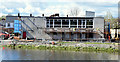
Queen's University boathouse, Stranmillis, Belfast (April 2015)
Work underway extending the Queen’s University boathouse, Lockview Road.
Image: © Albert Bridge
Taken: 30 Apr 2015
0.04 miles
5
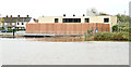
Queen's University boathouse, Stranmillis, Belfast - November 2015(1)
The completed building after a major renovation.
Image: © Albert Bridge
Taken: 9 Nov 2015
0.04 miles
6

National Cycle Network signs, Belfast
Image: © Albert Bridge
Taken: 16 Oct 2009
0.04 miles
7
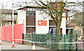
Queen's University boathouse, Stranmillis, Belfast (March 2015)
The southern end of the building.
Image: © Albert Bridge
Taken: 27 Mar 2015
0.04 miles
8

The Lagan towpath, Stranmillis, Belfast - December 2013 (1)
See Image (May 2007) and Image (December 2010). The same part of the towpath, behind the Stranmillis Wharf apartments Image, on a dull winter day.
Image: © Albert Bridge
Taken: 30 Dec 2013
0.05 miles
9

Stranmillis Wharf, Belfast
Part of a development of apartments close to the Governor’s Bridge Image This Image is the boat in the foreground.
Image: © Albert Bridge
Taken: 5 Jun 2009
0.05 miles
10

The Lagan towpath, Stranmillis, Belfast (August 2016)
The Lagan towpath, immediately upstream of the Governor’s Bridge, on a very wet day – so wet that it didn’t seem worthwhile going any further.
Image: © Albert Bridge
Taken: 19 Aug 2016
0.05 miles