IMAGES TAKEN NEAR TO
Sans Souci Park, BELFAST, BT9 5BZ

Introduction

This page details the photographs taken nearby to Sans Souci Park, BT9 5BZ by members of the Geograph project.

The Geograph project started in 2005 with the aim of publishing, organising and preserving representative images for every square kilometre of Great Britain, Ireland and the Isle of Man.

There are currently over 7.5m images from over14,400 individuals and you can help contribute to the project by visiting https://www.geograph.org.uk

Image Map


Images are licensed for reuse under creativecommons.org/licenses/by-sa/2.0
Notes
  • Clicking on the map will re-center to the selected point.
  • The higher the marker number, the further away the image location is from the centre of the postcode.

Image Listing (198 Images Found)

Images are licensed for reuse under creativecommons.org/licenses/by-sa/2.0
  • ...
Image
Details
Distance
1
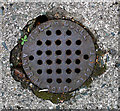
Drain cover, Belfast
Drain cover located in the driveway of a derelict house on Sans Souci Park, Belfast. Marked "Fred Riddell, Antrim Road, Belfast", this is probably the F. Riddell who is listed in the 1910 Belfast Street Directory as a "Plumber, Gasfitter and Bellhanger" and who lived at 177 Antrim Road. See also Image for a related image.
Image: © Rossographer Taken: 14 Jul 2011
0.01 miles
2
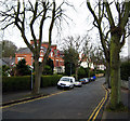
Sans Souci Park, Belfast
Another nice avenue off the Malone Road in Belfast.
Image: © Rossographer Taken: 5 Mar 2008
0.05 miles
3
Two Erinvale buses, Belfast
See Image The one on the right was running late and was being followed by the later bus which might have started to run a bit early as the first “poached” its passengers. The Malone Road just past Lennoxvale.
Image: © Albert Bridge Taken: 9 Sep 2009
0.10 miles
4
'Campus Watch' sign, Belfast
One of dozens erected around the university area of Belfast, this sign promotes the 'Campus Watch' scheme for students. Developed by the police in Belfast in partnership with the Northern Ireland Office, University of Ulster & Queen's Students' Union, it is similar to a neighbourhood watch scheme and promotes practical crime prevention for students.
Image: © Rossographer Taken: 12 Oct 2009
0.10 miles
5
Erinvale bus, Belfast
An inward service from Erinvale (8B via the Malone Road) calling at the stop near Windsor Avenue.
Image: © Albert Bridge Taken: 16 Oct 2009
0.10 miles
6
Signs, Malone Road
How to confuse the motorist - place six signs very close together on a short and busy stretch of road. Most of the signs relate to the bus lane which begins on the right of picture....and ends about 25m along the road. (I previously added a similar picture to this at Image).
Image: © Rossographer Taken: 24 Oct 2008
0.10 miles
7
Cavanagh access cover, Windsor Avenue, Belfast (March 2016)
A small Cavanagh cover (possibly over a stop cock) at the Malone Road end of Windsor Avenue.
Image: © Albert Bridge Taken: 20 Mar 2016
0.10 miles
8
Bus Lane, Malone Road Belfast [2]
Further along from Image with the Queen's University Ashby Building on the Stranmillis Road in the distance.
Image: © Rossographer Taken: 4 Mar 2008
0.11 miles
9
Street sign, Derryvolgie Avenue, Belfast (3of3)
See Image This one is on the opposite (north eastern) corner of the Malone Road.
Image: © Albert Bridge Taken: 25 Jun 2009
0.11 miles
10
Nos 66-68 Malone Road, Belfast - July 2015 (3)
A chimney (lacking some mortar) and eight pots
Image: © Albert Bridge Taken: 6 Jul 2015
0.11 miles
  • ...