
IMAGES TAKEN NEAR TO
Malone Road, BELFAST, BT9 5BW
Introduction
This page details the photographs taken nearby to Malone Road, BT9 5BW by members of the Geograph project.
The Geograph project started in 2005 with the aim of publishing, organising and preserving representative images for every square kilometre of Great Britain, Ireland and the Isle of Man.

There are currently over 7.5m images from over14,400 individuals and you can help contribute to the project by visiting https://www.geograph.org.uk
Image Map
Images are licensed for reuse under creativecommons.org/licenses/by-sa/2.0
Notes
- Clicking on the map will re-center to the selected point.
- The higher the marker number, the further away the image location is from the centre of the postcode.
Image Listing (77 Images Found)
Images are licensed for reuse under creativecommons.org/licenses/by-sa/2.0
Image
Details
Distance
1
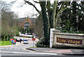
Elms Village, Malone Road, Belfast
The Elms 'Village' houses students of nearby Queen's University Belfast.
Image: © Rossographer
Taken: 4 Mar 2008
0.10 miles
2
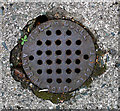
Drain cover, Belfast
Drain cover located in the driveway of a derelict house on Sans Souci Park, Belfast. Marked "Fred Riddell, Antrim Road, Belfast", this is probably the F. Riddell who is listed in the 1910 Belfast Street Directory as a "Plumber, Gasfitter and Bellhanger" and who lived at 177 Antrim Road. See also Image for a related image.
Image: © Rossographer
Taken: 14 Jul 2011
0.11 miles
3
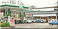
Spar and BP, Malone Road, Belfast (April 2018)
The students' favourite - Spar and BP (now with a post office) at 70-74 Malone Road. Built on the site of Sam McGredy's nursery https://en.wikipedia.org/wiki/Sam_McGredy.
Image: © Albert Bridge
Taken: 14 Apr 2018
0.14 miles
4
![Bus stop and shelter, Malone Road Belfast [detail]](https://s1.geograph.org.uk/photos/71/47/714733_4b53a552_120x120.jpg)
Bus stop and shelter, Malone Road Belfast [detail]
I had presumed that these electronic signs provided a live update of approaching buses. However, after using the Belfast Metro service for some time I realised that most (if not all) actually only provide an electronic version of the timetable.....which is printed in full inside the bus shelter behind me.
Image: © Rossographer
Taken: 5 Mar 2008
0.14 miles
5
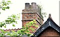
Nos 66-68 Malone Road, Belfast - July 2015 (3)
A chimney (lacking some mortar) and eight pots
Image: © Albert Bridge
Taken: 6 Jul 2015
0.14 miles
6
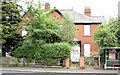
Nos 66-68 Malone Road, Belfast - July 2015 (2)
The two properties, boarded-up and partly hidden by trees, seen from across the Malone Road.
Image: © Albert Bridge
Taken: 6 Jul 2015
0.15 miles
7
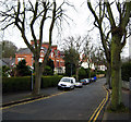
Sans Souci Park, Belfast
Another nice avenue off the Malone Road in Belfast.
Image: © Rossographer
Taken: 5 Mar 2008
0.15 miles
8
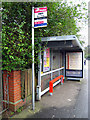
Bus stop and shelter, Malone Road Belfast
Bus stop and shelter on the country-bound side of the Malone Road by Sans Souci Park.
Image: © Rossographer
Taken: 5 Mar 2008
0.15 miles
9
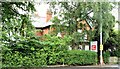
Nos 66-68 Malone Road, Belfast - July 2015 (1)
The two properties, boarded-up and partly hidden by trees, seen from the north.
Image: © Albert Bridge
Taken: 6 Jul 2015
0.15 miles
10
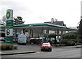
Petrol Station, Malone Road, Belfast
Today unleaded was selling at 106.9p per litre, with diesel at 111.9p.
Image: © Rossographer
Taken: 4 Mar 2008
0.15 miles