
IMAGES TAKEN NEAR TO
Malone Road, BELFAST, BT9 5BQ
Introduction
This page details the photographs taken nearby to Malone Road, BT9 5BQ by members of the Geograph project.
The Geograph project started in 2005 with the aim of publishing, organising and preserving representative images for every square kilometre of Great Britain, Ireland and the Isle of Man.

There are currently over 7.5m images from over14,400 individuals and you can help contribute to the project by visiting https://www.geograph.org.uk
Image Map
Images are licensed for reuse under creativecommons.org/licenses/by-sa/2.0
Notes
- Clicking on the map will re-center to the selected point.
- The higher the marker number, the further away the image location is from the centre of the postcode.
Image Listing (455 Images Found)
Images are licensed for reuse under creativecommons.org/licenses/by-sa/2.0
Image
Details
Distance
1
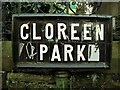
Street sign, Cloreen Park
Original Belfast tiled street sign for Cloreen Park in Belfast. See also Image
Image: © Rossographer
Taken: 16 Jan 2009
0.00 miles
2
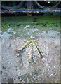
Bench Mark, Belfast
Rivet bench mark on the left hand side of the front wall running around Fisherwick Presbyterian Church on the Malone Road, Belfast Image The arrow points to a small brass rivet set into the top of the wall.
See also http://www.geograph.org.uk/search.php?i=11037856 for many other examples I have found.
Image: © Rossographer
Taken: 8 Mar 2010
0.00 miles
3

Nos 42-46 Malone Road, Belfast (March 2017)
A block of three shops, on the Malone Road, almost opposite Eglantine Avenue. A Pizza restaurant, Centra shop and a chip shop. The latter was previously “Gilgamesh”. Fisherwick Presbyterian church Image is on the right.
Image: © Albert Bridge
Taken: 15 Apr 2017
0.01 miles
4
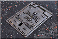
Belfast Water Works fire-hydrant cover, Belfast
There are still some reminders of the days of the Belfast Water Commissioners Image Image and Image This fire-hydrant cover is at Cloreen Park Image on the Malone Road.
Image: © Albert Bridge
Taken: 22 May 2011
0.01 miles
5

Fisherwick Presbyterian Church, Belfast
West and north sides of Fisherwick Presbyterian Church, on Belfast's Malone Road. Security barrier at lower right corner is entrance to Queen's University Ashby Building car park.
Image: © Neil Mitchell
Taken: 19 Mar 2010
0.02 miles
6
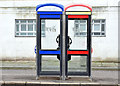
Telephone boxes, Malone Road, Belfast (December 2014)
Two “KX Plus” telephone boxes outside the David Keir Building. In some cases, where there are two, one is being removed - see Image and Image
Image: © Albert Bridge
Taken: 21 Dec 2014
0.02 miles
7
![David Keir Building, Belfast [detail]](https://s2.geograph.org.uk/photos/91/36/913670_b916abb5_120x120.jpg)
David Keir Building, Belfast [detail]
Large Queen's University science block on the Stranmillis Road. It was constructed 1951-57 to a design by Lanchester and Lodge of London.
This is a view of the front central portion - acceptable images of the entire building are impossible due to the vast size and close proximity of other properties. See also Image and Image
Image: © Rossographer
Taken: 8 Aug 2008
0.02 miles
8
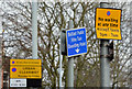
Waiting restriction signs, Malone Road, Belfast (March 2016)
Urban clearway and taxi rank signs, on the Malone Road, close to the “Bot” Image
Image: © Albert Bridge
Taken: 20 Mar 2016
0.02 miles
9

Entrance to 'The Bankers Club', Belfast
Located at 31 Malone Road - see http://www.bankers-club.co.uk/ for more information. Given the current economic climate a place to drown your sorrows perhaps?
Image: © Rossographer
Taken: 24 Oct 2008
0.03 miles
10
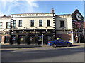
The Botanic Inn, Belfast
Pictured along University Road
Image: © Kenneth Allen
Taken: 7 Nov 2017
0.03 miles