
IMAGES TAKEN NEAR TO
Belfast Road, ENNISKILLEN, BT94 4ND
Introduction
This page details the photographs taken nearby to Belfast Road, BT94 4ND by members of the Geograph project.
The Geograph project started in 2005 with the aim of publishing, organising and preserving representative images for every square kilometre of Great Britain, Ireland and the Isle of Man.

There are currently over 7.5m images from over14,400 individuals and you can help contribute to the project by visiting https://www.geograph.org.uk
Image Map
Images are licensed for reuse under creativecommons.org/licenses/by-sa/2.0
Notes
- Clicking on the map will re-center to the selected point.
- The higher the marker number, the further away the image location is from the centre of the postcode.
Image Listing (19 Images Found)
Images are licensed for reuse under creativecommons.org/licenses/by-sa/2.0
Image
Details
Distance
1
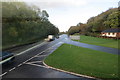
Brookeborough Co Fermanagh
Junction of B515 and A4 Belfast Road, Brookeborough.
Image: © Robert Ashby
Taken: 30 Oct 2013
0.03 miles
2
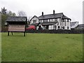
Northwick house, Brookeborough
It is located along the B515
Image: © Kenneth Allen
Taken: 12 Nov 2012
0.21 miles
3

Tempo / Brookeborough Credit Union
Pictured along Main Street, Brookeborough
Image: © Kenneth Allen
Taken: 12 Nov 2012
0.21 miles
4
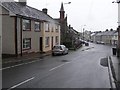
Brookeborough, County Fermanagh
Looking south-west
Image: © Kenneth Allen
Taken: 5 Aug 2008
0.22 miles
5
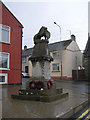
Memorial, Brookeborough
It is at the north end of the town
Image: © Kenneth Allen
Taken: 5 Aug 2008
0.22 miles
6
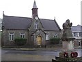
The Lady Brook Memorial Hall, Brookeborough
Built in 1891
Image: © Kenneth Allen
Taken: 5 Aug 2008
0.22 miles
7

Wesleyan Chapel, Brookeborough
It is located at the north end of the town
Dating from 1839, see close-up of plaque here Image]
Image: © Kenneth Allen
Taken: 5 Aug 2008
0.22 miles
8

B515, Brookeborough
Looking north-east
Image: © Kenneth Allen
Taken: 12 Nov 2012
0.22 miles
9
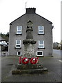
Boer War memorial, Brookeborough
It is located at the top of the street
Image: © Kenneth Allen
Taken: 12 Nov 2012
0.22 miles
10

The Lady Brooke Memorial Hall, Brookeborough
Located along Main Street, The Boer War memorial at the head of the town was carved by a local man named Harte in 1901. Behind it is the Lady Brooke Memorial Hall of the same date, a period building preserving all its original features including a clocktower and transverse stained glass window panels.
See close-up of plaque and clock here
Image]
Image]
Image: © Kenneth Allen
Taken: 12 Nov 2012
0.22 miles