IMAGES TAKEN NEAR TO
Liscreevin Road, ENNISKILLEN, BT94 1RU
Introduction
This page details the photographs taken nearby to Liscreevin Road, BT94 1RU by members of the Geograph project.
The Geograph project started in 2005 with the aim of publishing, organising and preserving representative images for every square kilometre of Great Britain, Ireland and the Isle of Man.

There are currently over 7.5m images from over14,400 individuals and you can help contribute to the project by visiting https://www.geograph.org.uk
Image Map
Images are licensed for reuse under creativecommons.org/licenses/by-sa/2.0
Notes
- Clicking on the map will re-center to the selected point.
- The higher the marker number, the further away the image location is from the centre of the postcode.
Image Listing (7 Images Found)
Images are licensed for reuse under creativecommons.org/licenses/by-sa/2.0
Image
Details
Distance
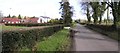
1
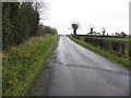
Liscreevin Road, Drumcrin
Heading ENE
Image: © Kenneth Allen
Taken: 15 Dec 2015
0.04 miles
2
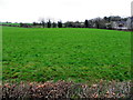
Boyaghan Townland
Pictured along Liscreevin Road
Image: © Kenneth Allen
Taken: 15 Dec 2015
0.12 miles
3
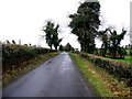
Liscreevin Road, Drumcrin
Heading west
Image: © Kenneth Allen
Taken: 15 Dec 2015
0.12 miles
4
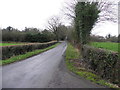
Liscreevin Road, Boyaghan
Heading WSW
Image: © Kenneth Allen
Taken: 15 Dec 2015
0.16 miles
5
Liscreen Road, Drumcrin
Heading ENE towards the town of Irvinestown.
Image: © Kenneth Allen
Taken: 6 Mar 2007
0.17 miles
6
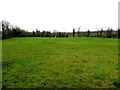
Drumcrin Townland
Looking north from Liscreevin Road
Image: © Kenneth Allen
Taken: 15 Dec 2015
0.18 miles
7
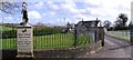
River Bend Equestrian Tack Shop
One of a pair of impressive statues at the entrance.
Image: © Kenneth Allen
Taken: 6 Mar 2007
0.20 miles