
IMAGES TAKEN NEAR TO
Killadeas Road, ENNISKILLEN, BT94 1PX
Introduction
This page details the photographs taken nearby to Killadeas Road, BT94 1PX by members of the Geograph project.
The Geograph project started in 2005 with the aim of publishing, organising and preserving representative images for every square kilometre of Great Britain, Ireland and the Isle of Man.

There are currently over 7.5m images from over14,400 individuals and you can help contribute to the project by visiting https://www.geograph.org.uk
Image Map
Images are licensed for reuse under creativecommons.org/licenses/by-sa/2.0
Notes
- Clicking on the map will re-center to the selected point.
- The higher the marker number, the further away the image location is from the centre of the postcode.
Image Listing (7 Images Found)
Images are licensed for reuse under creativecommons.org/licenses/by-sa/2.0
Image
Details
Distance
1

Pheasant at Glenkeen
Pictured at Old Castle Archdale entrance
Image: © Kenneth Allen
Taken: 18 Apr 2014
0.17 miles
2
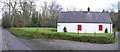
Oak Cottage
The road is heading north-east to Drumkeen. The back of the cottage faces the road. This is likely because the cottage existed before the road was built. The road was a "famine road" and was formed as a work scheme to give employment to poor people at the time of the Irish famine.
Image: © Kenneth Allen
Taken: 6 Mar 2007
0.18 miles
3

Road at Glenkeen
The road straight-on leads to Kesh, but you can turn off to the left to the same village taking the scenic route along the edge of Lough Erne.
Image: © Kenneth Allen
Taken: 6 Mar 2007
0.18 miles
4

Minor road junction on B82 at Glenkeen
The side road is the scenic route from Kesh overlooking parts of Lower Lough Erne.
Image: © Eric Jones
Taken: 27 Jul 2012
0.19 miles
5

Wandering branches to trees
Pictured beside Old Castle Archdale
Image: © Kenneth Allen
Taken: 2 May 2021
0.24 miles
6
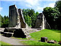
Ruined castle, Old Castle Archdale
ATTACKS, 1641 AND 1689
In the 1641 rising Castle Archdale was captured by Rory Maguire as part of the uprising to retake his lands forfeit in 1607. The heir, William Archdale, was saved by his nurse but the other Archdale children were murdered. The castle was repaired and inhabited until 1689. This time it was burnt out and abandoned.
Image: © Kenneth Allen
Taken: 17 Jul 2014
0.25 miles
7
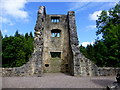
Castle tower, Old Castle Archdale
Part of this section was rebuilt
Image: © Kenneth Allen
Taken: 17 Jul 2014
0.25 miles