
IMAGES TAKEN NEAR TO
Rusheen Heights, ENNISKILLEN, BT93 4AB
Introduction
This page details the photographs taken nearby to Rusheen Heights, BT93 4AB by members of the Geograph project.
The Geograph project started in 2005 with the aim of publishing, organising and preserving representative images for every square kilometre of Great Britain, Ireland and the Isle of Man.

There are currently over 7.5m images from over14,400 individuals and you can help contribute to the project by visiting https://www.geograph.org.uk
Image Map
Images are licensed for reuse under creativecommons.org/licenses/by-sa/2.0
Notes
- Clicking on the map will re-center to the selected point.
- The higher the marker number, the further away the image location is from the centre of the postcode.
Image Listing (24 Images Found)
Images are licensed for reuse under creativecommons.org/licenses/by-sa/2.0
Image
Details
Distance
1
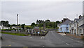
Road junction, Garrison
The B52 road to Belleek on the right with the Loughside Road running off to the left.
Image: © Rossographer
Taken: 30 Jun 2021
0.07 miles
2
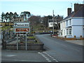
Leaving Garrison, County Fermanagh
Heading north through the townland of Knockarevan - past the Church Tower.
Image: © Dean Molyneaux
Taken: 21 Feb 2010
0.08 miles
3
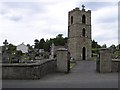
Church Tower, Garrison
These are quite common located in graveyards in some Irish towns, which may have been a throw-back to the old church.
Image: © Kenneth Allen
Taken: 20 May 2008
0.08 miles
4

Halla Naomh Mhuire, Garrison
In English "St. Mary's Hall". Located in the townland of Knockarevan, beside the Roman Catholic church (Our Lady Queen of Peace).
Image: © Dean Molyneaux
Taken: 21 Feb 2010
0.14 miles
5

The Melvin Bar, Garrison
Townland of Knockarevan (located in the village of Garrison, Co. Fermanagh).
Image: © Dean Molyneaux
Taken: 21 Feb 2010
0.14 miles
6
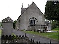
Garrison Church of Ireland
It is near the centre of the town
Image: © Kenneth Allen
Taken: 20 May 2008
0.14 miles
7
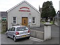
Garrison Church Hall
It belongs to the adjoining Church of Ireland
Image: © Kenneth Allen
Taken: 20 May 2008
0.14 miles
8

Garrison Church Hall
In front of the Church of Ireland.
Image: © Dean Molyneaux
Taken: 21 Feb 2010
0.14 miles
9
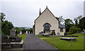
Garrison Parish Church
Parish church in the village of Garrison. There is a flush bracket bench mark on the south-eastern tip Image
Image: © Rossographer
Taken: 30 Jun 2021
0.15 miles
10
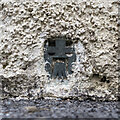
Flush Bracket, Garrison
Flush bracket bench mark on the south-eastern tip of Garrison Parish Church Image
A victim of sloppy rendering, it is just visible. The number on the bracket is OSBM 3324.
The mark has been levelled to 105.4 metres above MSL.
Image: © Rossographer
Taken: 30 Jun 2021
0.15 miles