
IMAGES TAKEN NEAR TO
Brollagh Road, ENNISKILLEN, BT93 3FU
Introduction
This page details the photographs taken nearby to Brollagh Road, BT93 3FU by members of the Geograph project.
The Geograph project started in 2005 with the aim of publishing, organising and preserving representative images for every square kilometre of Great Britain, Ireland and the Isle of Man.

There are currently over 7.5m images from over14,400 individuals and you can help contribute to the project by visiting https://www.geograph.org.uk
Image Map
Images are licensed for reuse under creativecommons.org/licenses/by-sa/2.0
Notes
- Clicking on the map will re-center to the selected point.
- The higher the marker number, the further away the image location is from the centre of the postcode.
Image Listing (6 Images Found)
Images are licensed for reuse under creativecommons.org/licenses/by-sa/2.0
Image
Details
Distance
1
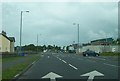
Approaching the Border at Belleek
The road directly ahead, the A46, leads to the Irish Republic and so does the road on the right -the B52 - briefly before doubling back into the UK as the A47. Immediately behind the photographer is the turnoff for the south-bound section of the B52 which heads towards the border villages of Garrison and Belcoo and which provides access to the westernmost areas of the UK
Image: © Eric Jones
Taken: 27 Jul 2012
0.20 miles
2
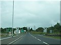
Where the A46 becomes the N3 at Belleek
The Republic of Ireland starts at the speed limit signs. It also extends along the right hand side of the road. During The Troubles Belleek was regarded as a particularly hazardous posting. The following link show border control in the more peaceful early 1950s.
http://www.bbc.co.uk/programmes/p00hm0zx
Image: © Eric Jones
Taken: 27 Jul 2012
0.22 miles
3
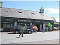
Costcutter's Cloghore, County Donegal
A very busy store, including fuel sales, which is just over the border from Belleek in Northern Ireland.
Image: © Kenneth Allen
Taken: 17 Jul 2006
0.24 miles
4
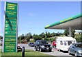
Straddle Service Station, DUN NA nGALL (Donegal)
It is part of the Costcutter's store. One of the flourishing locations which has taken advantage of the 11p per litre difference for unleaded petrol, between the two countries and it has led to the demise of filling stations in Northern Ireland located near border areas which can't compete. Incidentally the personalised number plate on the 4x4 must be worth a bob or two, "OIL1". A similar County Fermanagh registration (BIG1) was sold recently for £80,000 plus VAT and additional fees - http://www.personallyyours.co.uk/number-plate-news/BIG1_number_plate-12062006.htm
Image: © Kenneth Allen
Taken: 17 Jul 2006
0.24 miles
5
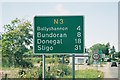
Westernmost A-road sign in the UK
This is the last roadsign in the UK, travelling westwards from Belleek into Co. Donegal, Republic of Ireland. The green sign in the background has a noticeably different typeface (unclear here) – than that used on the UK's signage – and the distance to Ballyshannon is shown as 7 (kilometres) instead of 4 (miles).
Image: © Chris Downer
Taken: 22 Aug 2005
0.24 miles
6
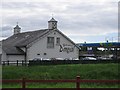
Welcome to Donegal
A filling station in the wedge of Donegal at Belleek. Travelling around Lower Lough Erne, there is the need for two quick international border crossings - a perfect place to take advantage of price differentials. Taken between my sixth and seventh border crossing of the day.
Image: © Richard Webb
Taken: 20 Jul 2012
0.25 miles