
IMAGES TAKEN NEAR TO
Tully Meadows, ENNISKILLEN, BT92 2BS
Introduction
This page details the photographs taken nearby to Tully Meadows, BT92 2BS by members of the Geograph project.
The Geograph project started in 2005 with the aim of publishing, organising and preserving representative images for every square kilometre of Great Britain, Ireland and the Isle of Man.

There are currently over 7.5m images from over14,400 individuals and you can help contribute to the project by visiting https://www.geograph.org.uk
Image Map
Images are licensed for reuse under creativecommons.org/licenses/by-sa/2.0
Notes
- Clicking on the map will re-center to the selected point.
- The higher the marker number, the further away the image location is from the centre of the postcode.
Image Listing (6 Images Found)
Images are licensed for reuse under creativecommons.org/licenses/by-sa/2.0
Image
Details
Distance
1
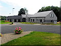
Cleenish Centre, Bellanaleck
It is located at Rectory Lane
Image: © Kenneth Allen
Taken: 23 Jul 2014
0.15 miles
2
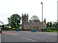
The Church of Ireland Parish Church at Bellanaleck
Bellanaleck has a population of 213. In contrast to its neighbouring village, Derrylin, Bellanaleck is predominantly Unionist with 71 per cent of the population being of the Protestant persuasion.
Image: © Eric Jones
Taken: 27 Jun 2011
0.18 miles
3
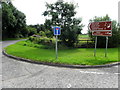
Sign for Cleenish Island
Pictured along Derrylin Road
Image: © Kenneth Allen
Taken: 23 Jul 2014
0.19 miles
4
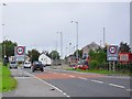
Approaching Bellanaleck
Along the A509 at the southern end of the village.
Image: © Dean Molyneaux
Taken: 29 Aug 2009
0.19 miles
5
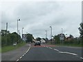
The A509 on the southern outskirts of Bellanaleck
Image: © Eric Jones
Taken: 27 Jun 2011
0.24 miles
6
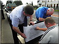
Headstone rubbing, Bellanaleck
Pictured outside the graveyard, the sculptor has to make alterations to a headstone. He is using a heelball stick which is a substance composed of lampblack and wax used for making rubbings or for polishing shoes.
In addition to this the mobile phone was taken out to record the picture.
Image: © Kenneth Allen
Taken: 23 Jul 2014
0.24 miles