IMAGES TAKEN NEAR TO
Breda Court, BELFAST, BT8 6JB
Introduction
This page details the photographs taken nearby to Breda Court, BT8 6JB by members of the Geograph project.
The Geograph project started in 2005 with the aim of publishing, organising and preserving representative images for every square kilometre of Great Britain, Ireland and the Isle of Man.

There are currently over 7.5m images from over14,400 individuals and you can help contribute to the project by visiting https://www.geograph.org.uk
Image Map
Images are licensed for reuse under creativecommons.org/licenses/by-sa/2.0
Notes
- Clicking on the map will re-center to the selected point.
- The higher the marker number, the further away the image location is from the centre of the postcode.
Image Listing (58 Images Found)
Images are licensed for reuse under creativecommons.org/licenses/by-sa/2.0
Image
Details
Distance
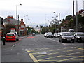
2
Breda Park Road at Knockbreda
The image was taken from the A24.
Image: © Eric Jones
Taken: 21 Jun 2019
0.06 miles
3
The Saintfield Road, Belfast (4)
The inward view along the Saintfield Road, as it crosses the Belfast outer ring road Image, close to the Forestside Shopping Centre (formerly the “Supermac” site) Image (background).
Image: © Albert Bridge
Taken: 21 Sep 2011
0.07 miles
4
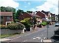
Mount Oriel, Newtownbreda, Belfast
A street off the Saintfield Road at the Inns Cross (Newtownbreda).
Image: © Dean Molyneaux
Taken: 24 Sep 2009
0.07 miles
5
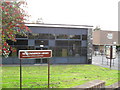
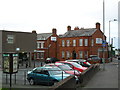
Newtownbreda Library, Belfast
On the Saintfield Road at Inns Cross.
Image: © Dean Molyneaux
Taken: 24 Sep 2009
0.09 miles
6
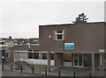
The Mount Oriel Day Care Centre, Knockbreda
This is located on a cul-de-sac off the Saintfield Road. It is next door to the Newtownbreda Branch Library.
Image: © Eric Jones
Taken: 15 Feb 2012
0.09 miles
7
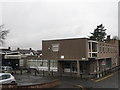
Library and day care service centre at Newtownbreda
Image: © Eric Jones
Taken: 12 Mar 2011
0.10 miles
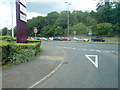
8
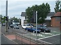
Stationary traffic on the A55 at the cross roads with the A24
Image: © Eric Jones
Taken: 30 Jun 2015
0.11 miles
9
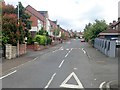
Saintfield Road at Inns Cross, Belfast
Saintfield Road at the Inns (Newton Park/School Road). Looking towards Belfast and Forestside.
Image: © Dean Molyneaux
Taken: 24 Sep 2009
0.13 miles
10
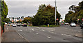
The A24 crossroads on the A55 (Upper Knockbreda Road)
The A55 road forms Belfast's outer-ring road.
Image: © Eric Jones
Taken: 21 Jun 2019
0.13 miles