IMAGES TAKEN NEAR TO
Ingleside Heights, STRABANE, BT82 8QZ
Introduction
This page details the photographs taken nearby to Ingleside Heights, BT82 8QZ by members of the Geograph project.
The Geograph project started in 2005 with the aim of publishing, organising and preserving representative images for every square kilometre of Great Britain, Ireland and the Isle of Man.

There are currently over 7.5m images from over14,400 individuals and you can help contribute to the project by visiting https://www.geograph.org.uk
Image Map
Images are licensed for reuse under creativecommons.org/licenses/by-sa/2.0
Notes
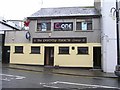
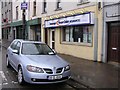
- Clicking on the map will re-center to the selected point.
- The higher the marker number, the further away the image location is from the centre of the postcode.
Image Listing (362 Images Found)
Images are licensed for reuse under creativecommons.org/licenses/by-sa/2.0
Image
Details
Distance
1
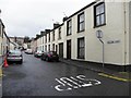
Newtown Street, Strabane
Viewed from Patrick Street
Image: © Kenneth Allen
Taken: 6 Jan 2012
0.10 miles
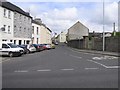
2
Newtown Place, Stabane
Looking east from Derry Road
Image: © Kenneth Allen
Taken: 6 Jan 2012
0.10 miles
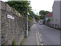
3
Patrick Street, Strabane
Heading NNW towards the Derry Road
Image: © Kenneth Allen
Taken: 22 May 2009
0.10 miles
4
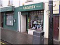
Argosy, Strabane
This newsagents is located at High Street
Image: © Kenneth Allen
Taken: 6 Mar 2009
0.10 miles
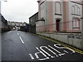
5
Church Street, Strabane
Heading north-east
Image: © Kenneth Allen
Taken: 22 May 2009
0.10 miles
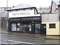
6
Polly's Roots, Strabane
This café is located at High Street
Image: © Kenneth Allen
Taken: 6 Mar 2009
0.11 miles
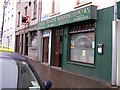
7
Kashyap, Strabane
It is located at High Street
Image: © Kenneth Allen
Taken: 6 Mar 2009
0.11 miles
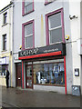
8
hair@karen's, Strabane
It is located at High Street
Image: © Kenneth Allen
Taken: 6 Mar 2009
0.11 miles
9
Paddy Mac's, Strabane
It is located at High Street
Image: © Kenneth Allen
Taken: 6 Mar 2009
0.11 miles
10
Cavanagh Hooper Dolan, Strabane
It is located at High Street
Image: © Kenneth Allen
Taken: 6 Mar 2009
0.11 miles