IMAGES TAKEN NEAR TO
Lisnaragh Road, STRABANE, BT82 0SD
Introduction
This page details the photographs taken nearby to Lisnaragh Road, BT82 0SD by members of the Geograph project.
The Geograph project started in 2005 with the aim of publishing, organising and preserving representative images for every square kilometre of Great Britain, Ireland and the Isle of Man.

There are currently over 7.5m images from over14,400 individuals and you can help contribute to the project by visiting https://www.geograph.org.uk
Image Map
Images are licensed for reuse under creativecommons.org/licenses/by-sa/2.0
Notes
- Clicking on the map will re-center to the selected point.
- The higher the marker number, the further away the image location is from the centre of the postcode.
Image Listing (10 Images Found)
Images are licensed for reuse under creativecommons.org/licenses/by-sa/2.0
Image
Details
Distance
1
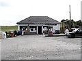
P Kerlin, Aghabrack
This small shop is on the roadside between Donemana and Plumbridge
Image: © Kenneth Allen
Taken: 25 Jul 2006
0.04 miles
2
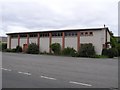
Aghabrack Community Hall
It is located half-way between Donemana and Plumbridge
Image: © Kenneth Allen
Taken: 11 Jul 2006
0.10 miles
3
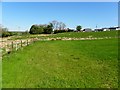
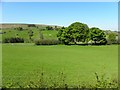
Aghabrack Townland
Looking NNW from Aghabrack Road
Image: © Kenneth Allen
Taken: 29 May 2013
0.11 miles
4
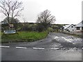
Aghabrack Road, Aghabrack
Heading WSW from Lisnaragh Road
Image: © Kenneth Allen
Taken: 29 May 2013
0.17 miles
5
Aghabrack Road, Aghabrack
Heading ESE from Lisnaragh Road towards Moorlough
Image: © Kenneth Allen
Taken: 22 Jan 2014
0.17 miles
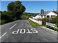
6
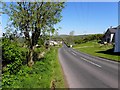
Lisnaragh Road
Heading NNW at Aghabrack
Image: © Kenneth Allen
Taken: 29 May 2013
0.17 miles
7
Aghabrack RC Church
You would nearly think that this picture was in mono if you didn't see the green grass.
Image: © Kenneth Allen
Taken: 11 Jul 2006
0.18 miles
8
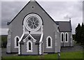
St Mary's Church, Aghabrack
Pictured along Lisnaragh Road
Image: © Kenneth Allen
Taken: 29 May 2013
0.18 miles
9
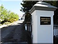
Entrance, St Mary's RC Church, Aghabrack
Pictured along Lisnaragh Road
See church here Image]
Image: © Kenneth Allen
Taken: 29 May 2013
0.20 miles
10
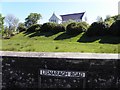
Aghabrack Townland
Looking SSW from Lisnaragh Road
Image: © Kenneth Allen
Taken: 29 May 2013
0.23 miles