IMAGES TAKEN NEAR TO
Lislaird Road, CASTLEDERG, BT81 7XX
Introduction
This page details the photographs taken nearby to Lislaird Road, BT81 7XX by members of the Geograph project.
The Geograph project started in 2005 with the aim of publishing, organising and preserving representative images for every square kilometre of Great Britain, Ireland and the Isle of Man.

There are currently over 7.5m images from over14,400 individuals and you can help contribute to the project by visiting https://www.geograph.org.uk
Image Map
Images are licensed for reuse under creativecommons.org/licenses/by-sa/2.0
Notes
- Clicking on the map will re-center to the selected point.
- The higher the marker number, the further away the image location is from the centre of the postcode.
Image Listing (7 Images Found)
Images are licensed for reuse under creativecommons.org/licenses/by-sa/2.0
Image
Details
Distance
1
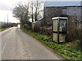
Telephone box at Lisnacloon
Located on the Mournebeg Road, between Castlederg and Aghyaran, in the townland of Lisnacloon, this BT call box does not appear to get much use. It is linked to the Castlederg telephone exchange.
Image: © Dean Molyneaux
Taken: 23 Mar 2014
0.14 miles
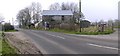
2
Bus shelter, Lisnacloon
Pictured along Lislaird Road
Image: © Kenneth Allen
Taken: 29 Apr 2014
0.14 miles
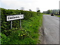
3
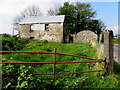
Stone barn, Lisnacloon
It is located at the corner of Lislaird Road and Kilcroagh Road
Image: © Kenneth Allen
Taken: 29 Apr 2014
0.15 miles
4
Kilcroagh Road, Lisnacloon
Heading south-west towards Killeter
Image: © Kenneth Allen
Taken: 29 Apr 2014
0.15 miles
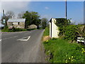
5
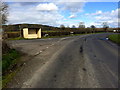
Junction at Lisnacloon
This is where the Lislaird Road meets the Mournebeg Road in the townland of Lisnacloon, just outside the town of Castlederg.
Image: © Dean Molyneaux
Taken: 23 Mar 2014
0.15 miles
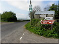
6
Road at Lisnacloon
Heading towards Killeter
Image: © Kenneth Allen
Taken: 27 Mar 2007
0.16 miles
7
Kilcroagh Road
Heading ENE towards Castlederg
Image: © Kenneth Allen
Taken: 29 Apr 2014
0.19 miles