IMAGES TAKEN NEAR TO
Woodside Road, CASTLEDERG, BT81 7TA
Introduction
This page details the photographs taken nearby to Woodside Road, BT81 7TA by members of the Geograph project.
The Geograph project started in 2005 with the aim of publishing, organising and preserving representative images for every square kilometre of Great Britain, Ireland and the Isle of Man.

There are currently over 7.5m images from over14,400 individuals and you can help contribute to the project by visiting https://www.geograph.org.uk
Image Map
Images are licensed for reuse under creativecommons.org/licenses/by-sa/2.0
Notes
- Clicking on the map will re-center to the selected point.
- The higher the marker number, the further away the image location is from the centre of the postcode.
Image Listing (18 Images Found)
Images are licensed for reuse under creativecommons.org/licenses/by-sa/2.0
Image
Details
Distance
1
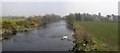
The River Derg
Pictured at Lisnacloon.
Image: © Kenneth Allen
Taken: 27 Mar 2007
0.10 miles
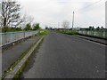
3
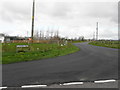
Glashagh Road
Heading north-west from Ganvaghan Road
Image: © Kenneth Allen
Taken: 14 Apr 2014
0.11 miles
4
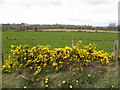
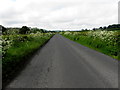
Whins, Creeduff
Pictured along Woodside Road
This is the time of year when they are most fragrant
Image: © Kenneth Allen
Taken: 14 Apr 2014
0.12 miles
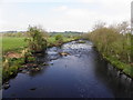
6
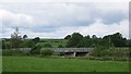
Road bridge, River Derg
A concrete road bridge by Glashagh.
Image: © Richard Webb
Taken: 20 Jul 2012
0.13 miles
7
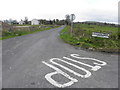
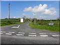
Riverview Road, Creeduff
Heading south from the junction with Ganvanagh Road and Woodside Road
Image: © Kenneth Allen
Taken: 14 Apr 2014
0.14 miles
8
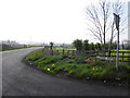
Glashagh Road
Heading SSE from Magheranageeragh Road
Image: © Kenneth Allen
Taken: 29 Apr 2014
0.18 miles
9
Magheranageeragh Road, Lislaird
Heading south-west
Image: © Kenneth Allen
Taken: 27 May 2014
0.19 miles
10
Fort Road, Lislaird
Heading north-west from Magheranageeragh Road
Image: © Kenneth Allen
Taken: 29 Apr 2014
0.19 miles