IMAGES TAKEN NEAR TO
Scraghy Road, CASTLEDERG, BT81 7SP
Introduction
This page details the photographs taken nearby to Scraghy Road, BT81 7SP by members of the Geograph project.
The Geograph project started in 2005 with the aim of publishing, organising and preserving representative images for every square kilometre of Great Britain, Ireland and the Isle of Man.

There are currently over 7.5m images from over14,400 individuals and you can help contribute to the project by visiting https://www.geograph.org.uk
Image Map
Images are licensed for reuse under creativecommons.org/licenses/by-sa/2.0
Notes
- Clicking on the map will re-center to the selected point.
- The higher the marker number, the further away the image location is from the centre of the postcode.
Image Listing (11 Images Found)
Images are licensed for reuse under creativecommons.org/licenses/by-sa/2.0
Image
Details
Distance
1
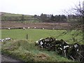
Meenclogher Townland
Some dry stone walls are to be found in this locality
Image: © Kenneth Allen
Taken: 19 Jan 2008
0.05 miles
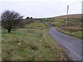
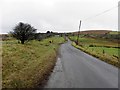
2
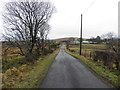
Scraghy Road, Scraghy
Heading eastwards
Image: © Kenneth Allen
Taken: 19 Feb 2014
0.08 miles
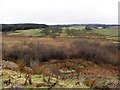
3
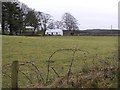
Tawnydorragh Townland
A little croft in the edge of the Fermanagh countryside
Image: © Kenneth Allen
Taken: 19 Jan 2008
0.09 miles
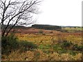
4
Meenclogher Townland
A view to the north-east
Image: © Kenneth Allen
Taken: 19 Jan 2008
0.11 miles
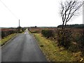
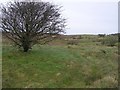
5
Heathland, Scraghy
Looking north from Scraghy Road
There is supposed to be a stone circle somewhere here
Image: © Kenneth Allen
Taken: 19 Feb 2014
0.12 miles
6
Scraghy Road
It is located at Meenclogher
Image: © Kenneth Allen
Taken: 19 Jan 2008
0.12 miles
7
Scraghy Townland
Looking north from Scraghy Road
Image: © Kenneth Allen
Taken: 19 Feb 2014
0.14 miles
9
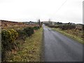
Scraghy Road
Heading east at Meenclogher
Image: © Kenneth Allen
Taken: 19 Feb 2014
0.18 miles