IMAGES TAKEN NEAR TO
Bullock Park Road, CASTLEDERG, BT81 7RL
Introduction
This page details the photographs taken nearby to Bullock Park Road, BT81 7RL by members of the Geograph project.
The Geograph project started in 2005 with the aim of publishing, organising and preserving representative images for every square kilometre of Great Britain, Ireland and the Isle of Man.

There are currently over 7.5m images from over14,400 individuals and you can help contribute to the project by visiting https://www.geograph.org.uk
Image Map
Images are licensed for reuse under creativecommons.org/licenses/by-sa/2.0
Notes
- Clicking on the map will re-center to the selected point.
- The higher the marker number, the further away the image location is from the centre of the postcode.
Image Listing (16 Images Found)
Images are licensed for reuse under creativecommons.org/licenses/by-sa/2.0
Image
Details
Distance
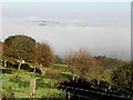
1
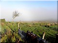
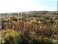
Misty at Bullock Park
Pictured along Kirlish Road
Image: © Kenneth Allen
Taken: 15 Oct 2013
0.02 miles
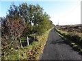
2
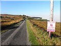
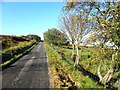
Kirlish Road
Heading west - Caution children playing ahead!
Image: © Kenneth Allen
Taken: 15 Oct 2013
0.02 miles
3
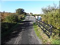
Kirlish Road
Heading west from Meencargagh towards Bullock Park
Image: © Kenneth Allen
Taken: 15 Oct 2013
0.04 miles
4
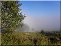
Misty at Bullock Park
Pictured along Kirlish Road
Image: © Kenneth Allen
Taken: 15 Oct 2013
0.07 miles
5
Bogland, Meencargagh
Looking south from Kirlish Road
Image: © Kenneth Allen
Taken: 15 Oct 2013
0.08 miles
7
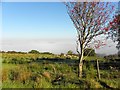
Rowan tree, Meencargagh
Pictured along Kirlish Road
Image: © Kenneth Allen
Taken: 15 Oct 2013
0.16 miles
8
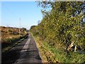
Kirlish Road, Meencargagh
Heading west
Image: © Kenneth Allen
Taken: 15 Oct 2013
0.16 miles
9
Misty at Meencargagh
Looking north-west
Image: © Kenneth Allen
Taken: 15 Oct 2013
0.18 miles
10
Kirlish Road, Meencargagh
Heading east
Image: © Kenneth Allen
Taken: 15 Oct 2013
0.20 miles