IMAGES TAKEN NEAR TO
Lurganboy Road, CASTLEDERG, BT81 7HS
Introduction
This page details the photographs taken nearby to Lurganboy Road, BT81 7HS by members of the Geograph project.
The Geograph project started in 2005 with the aim of publishing, organising and preserving representative images for every square kilometre of Great Britain, Ireland and the Isle of Man.

There are currently over 7.5m images from over14,400 individuals and you can help contribute to the project by visiting https://www.geograph.org.uk
Image Map
Images are licensed for reuse under creativecommons.org/licenses/by-sa/2.0
Notes
- Clicking on the map will re-center to the selected point.
- The higher the marker number, the further away the image location is from the centre of the postcode.
Image Listing (341 Images Found)
Images are licensed for reuse under creativecommons.org/licenses/by-sa/2.0
Image
Details
Distance
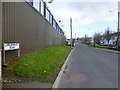
1
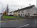
Breezemount Park, Castlederg
It is located along Lurganboy Road
Image: © Kenneth Allen
Taken: 2 Nov 2010
0.02 miles
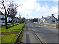
2
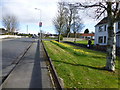
Lurganboy Road, Castlederg
Heading NNE
Image: © Kenneth Allen
Taken: 5 Apr 2016
0.03 miles
3
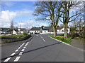
Side road, Castlederg
Heading west to Lurganboy Road
Image: © Kenneth Allen
Taken: 5 Apr 2016
0.05 miles
4
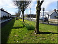
Daffodil display along Breezemount Park
Looking SSW
Image: © Kenneth Allen
Taken: 5 Apr 2016
0.05 miles
5
Lurganboy Road, Castlederg
Heading NNE
Image: © Kenneth Allen
Taken: 5 Apr 2016
0.06 miles
6

Lurganbuoy Road
Heading SSW towards The Diamond, Castlederg
Image: © Kenneth Allen
Taken: 20 Feb 2019
0.06 miles
7
Lurganboy Road
Heading SSW to Castlederg
Image: © Kenneth Allen
Taken: 5 Apr 2016
0.07 miles
8
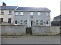
St Patrick's Close, Castlederg
A collection of flats located along Castlefin Road
Image: © Kenneth Allen
Taken: 5 Apr 2016
0.07 miles
9
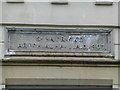
Plaque, St Patrick's Parochial Hall A.D. 1907
Pictured here Image]
Image: © Kenneth Allen
Taken: 5 Apr 2016
0.08 miles
10
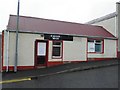
Barber shop, Castlederg
It is located along Lurganboy Road
Image: © Kenneth Allen
Taken: 2 Nov 2010
0.08 miles