IMAGES TAKEN NEAR TO
Blane Road, CASTLEDERG, BT81 7DU
Introduction
This page details the photographs taken nearby to Blane Road, BT81 7DU by members of the Geograph project.
The Geograph project started in 2005 with the aim of publishing, organising and preserving representative images for every square kilometre of Great Britain, Ireland and the Isle of Man.

There are currently over 7.5m images from over14,400 individuals and you can help contribute to the project by visiting https://www.geograph.org.uk
Image Map
Images are licensed for reuse under creativecommons.org/licenses/by-sa/2.0
Notes
- Clicking on the map will re-center to the selected point.
- The higher the marker number, the further away the image location is from the centre of the postcode.
Image Listing (9 Images Found)
Images are licensed for reuse under creativecommons.org/licenses/by-sa/2.0
Image
Details
Distance
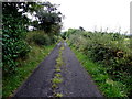
1
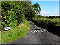
Blane Road, Garvagh
Heading NNW from Laghtfoggy Road
Image: © Kenneth Allen
Taken: 3 Sep 2014
0.06 miles
2
Bridge along Laghtfoggy Road
Heading WNW from Garvagh to Laghtmorris and Laghtfoggy
Image: © Kenneth Allen
Taken: 3 Sep 2014
0.10 miles
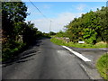
3
Laght Road, Laghtmorris
Laghtfoggy Road branches off to the left
Image: © Kenneth Allen
Taken: 3 Sep 2014
0.11 miles
4
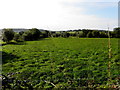
Laghtmorris Townland
Looking south-west
Image: © Kenneth Allen
Taken: 3 Sep 2014
0.12 miles
6
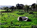
Boulder in a field.Laghtmorris
Looks like a piece of sculpture!
Pictured along Laghtfoggy Road
Image: © Kenneth Allen
Taken: 3 Sep 2014
0.15 miles
7
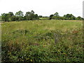
Laghtmorris Townland
Looking left from Laght Road
Image: © Kenneth Allen
Taken: 3 Sep 2014
0.18 miles
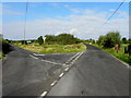
8
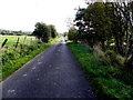
Laghtfoggy Road, Laghtmorris
Heading east
Image: © Kenneth Allen
Taken: 3 Sep 2014
0.21 miles
9
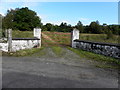
Gate entrance, Laghtmorris
Pictured along Laghtfoggy Road
Image: © Kenneth Allen
Taken: 3 Sep 2014
0.25 miles