
IMAGES TAKEN NEAR TO
Sessiagh Road, COOKSTOWN, BT80 8UF
Introduction
This page details the photographs taken nearby to Sessiagh Road, BT80 8UF by members of the Geograph project.
The Geograph project started in 2005 with the aim of publishing, organising and preserving representative images for every square kilometre of Great Britain, Ireland and the Isle of Man.

There are currently over 7.5m images from over14,400 individuals and you can help contribute to the project by visiting https://www.geograph.org.uk
Image Map
Images are licensed for reuse under creativecommons.org/licenses/by-sa/2.0
Notes
- Clicking on the map will re-center to the selected point.
- The higher the marker number, the further away the image location is from the centre of the postcode.
Image Listing (7 Images Found)
Images are licensed for reuse under creativecommons.org/licenses/by-sa/2.0
Image
Details
Distance
1
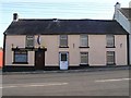
Half way bar, Tullaghoge
It is in the centre of the village
Image: © Kenneth Allen
Taken: 6 Nov 2006
0.13 miles
2
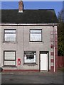
Tullaghoge Post Office
Located at the west of the village
Image: © Kenneth Allen
Taken: 6 Nov 2006
0.13 miles
3
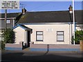
Tullyhogue Orange Hall
The spelling is different from that of the village.
Image: © Kenneth Allen
Taken: 6 Nov 2006
0.13 miles
4
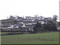
Tullyhogue village from Donaghrisk Old Graveyard
Image: © HENRY CLARK
Taken: 9 Apr 2010
0.13 miles
5
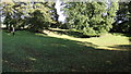
Tullyhogue Fort
The ancient seat of the O'Neills, Chieftains of Ulster. This view is across the centre of the meeting area where the chieftains were inaugurated. The 'seat' itself is believed to have been stolen and destroyed.
Image: © Iain Crump
Taken: 4 Oct 2009
0.25 miles
6
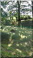
Tullyhogue Fort
Looking from the top of the earthworks surrounding the central arena, southwest across the inner rings.
Image: © Iain Crump
Taken: 4 Oct 2009
0.25 miles
7
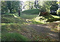
Tullyhogue Fort
Looking across the earthworks, towards the inner meeting area where the O'Neills were crowned Chiefs of Ulster.
Image: © Iain Crump
Taken: 4 Oct 2009
0.25 miles