IMAGES TAKEN NEAR TO
Loughmacrory Road, OMAGH, BT79 9LG
Introduction
This page details the photographs taken nearby to Loughmacrory Road, BT79 9LG by members of the Geograph project.
The Geograph project started in 2005 with the aim of publishing, organising and preserving representative images for every square kilometre of Great Britain, Ireland and the Isle of Man.

There are currently over 7.5m images from over14,400 individuals and you can help contribute to the project by visiting https://www.geograph.org.uk
Image Map
Images are licensed for reuse under creativecommons.org/licenses/by-sa/2.0
Notes
- Clicking on the map will re-center to the selected point.
- The higher the marker number, the further away the image location is from the centre of the postcode.
Image Listing (96 Images Found)
Images are licensed for reuse under creativecommons.org/licenses/by-sa/2.0
Image
Details
Distance
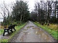
1
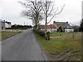
Loughmacrory Road, Loughmacrory
Heading towards the village
Image: © Kenneth Allen
Taken: 4 Mar 2013
0.01 miles
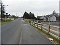
2
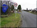
Welcoming sign for Loughmacrory
Heading WSW along Loughmacrory Road
Image: © Kenneth Allen
Taken: 4 Mar 2013
0.04 miles
3
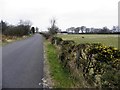
Loughmacrory Road
Heading WSW towards Loughmacrory
Image: © Kenneth Allen
Taken: 4 Mar 2013
0.10 miles
4
Countryside at Loughmacrory
Looking south-east
Image: © Kenneth Allen
Taken: 21 Jan 2014
0.15 miles
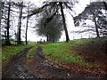
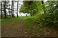
5
A muddy path, Loughmacrory
It takes you round the edge of the lough
Image: © Kenneth Allen
Taken: 21 Jan 2014
0.16 miles
6
Loughmacrory Road
Heading WSW at Loughmacrory
Image: © Kenneth Allen
Taken: 4 Mar 2013
0.16 miles
7
Loughmacrory Townland
Looking south-east beside Loughmacrory Lough
Image: © Kenneth Allen
Taken: 12 May 2019
0.16 miles
8
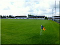
GAA football pitch, Loughmacrory
Looking south-west
Image: © Kenneth Allen
Taken: 26 May 2014
0.17 miles
9

Woodland, Loughmacrory
Looking south-west
Image: © Kenneth Allen
Taken: 17 Oct 2013
0.18 miles
10
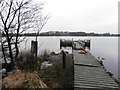
Jetty, Loughmacrory Lough
Looking north-west
Image: © Kenneth Allen
Taken: 27 Feb 2013
0.18 miles