IMAGES TAKEN NEAR TO
Mullanmore Road, OMAGH, BT79 9LA
Introduction
This page details the photographs taken nearby to Mullanmore Road, BT79 9LA by members of the Geograph project.
The Geograph project started in 2005 with the aim of publishing, organising and preserving representative images for every square kilometre of Great Britain, Ireland and the Isle of Man.

There are currently over 7.5m images from over14,400 individuals and you can help contribute to the project by visiting https://www.geograph.org.uk
Image Map
Images are licensed for reuse under creativecommons.org/licenses/by-sa/2.0
Notes
- Clicking on the map will re-center to the selected point.
- The higher the marker number, the further away the image location is from the centre of the postcode.
Image Listing (14 Images Found)
Images are licensed for reuse under creativecommons.org/licenses/by-sa/2.0
Image
Details
Distance
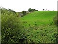
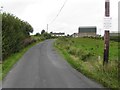
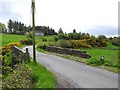
1
Mullanmore Road
Heading north-west at Aghagreggan / Mullanmore
Image: © Kenneth Allen
Taken: 20 Aug 2013
0.03 miles
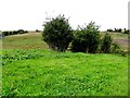
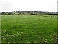
2
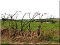
Remains of whins, Aghnagreggan
Pictured along Mullanmore Road
Image: © Kenneth Allen
Taken: 20 Aug 2013
0.06 miles
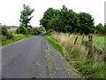
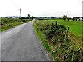
3
Mullanmore Road
Heading south-east towards Aghnagreggan
Image: © Kenneth Allen
Taken: 20 Aug 2013
0.07 miles
4
Rowan trees, Aghnagreggan
Pictured along Mullanmore Road
Image: © Kenneth Allen
Taken: 20 Aug 2013
0.08 miles
5
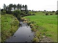
Granagh Burn, Mullanmore / Altnagreggan
It flows to join the Camowen River
Image: © Kenneth Allen
Taken: 20 Aug 2013
0.11 miles
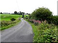
6
Mullanmore Road, Mullanmore
Heading north-west
Image: © Kenneth Allen
Taken: 20 Aug 2013
0.12 miles
7
Mullanmore Road
Heading SSE at Aghnagreggan
Image: © Kenneth Allen
Taken: 20 Aug 2013
0.12 miles
8
Aghnagreggan, Carrickmore
The traditional stone bridge spans the Granagh Burn
Image: © Kenneth Allen
Taken: 16 May 2006
0.12 miles
9
Mullanmore Townland
Pictured along Mullanmore Road
Image: © Kenneth Allen
Taken: 20 Aug 2013
0.13 miles