IMAGES TAKEN NEAR TO
Altamuskin Road, OMAGH, BT79 9JB
Introduction
This page details the photographs taken nearby to Altamuskin Road, BT79 9JB by members of the Geograph project.
The Geograph project started in 2005 with the aim of publishing, organising and preserving representative images for every square kilometre of Great Britain, Ireland and the Isle of Man.

There are currently over 7.5m images from over14,400 individuals and you can help contribute to the project by visiting https://www.geograph.org.uk
Image Map
Images are licensed for reuse under creativecommons.org/licenses/by-sa/2.0
Notes
- Clicking on the map will re-center to the selected point.
- The higher the marker number, the further away the image location is from the centre of the postcode.
Image Listing (17 Images Found)
Images are licensed for reuse under creativecommons.org/licenses/by-sa/2.0
Image
Details
Distance
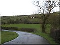
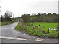
1
Caldragh Road
Facing north towards the junction with Altamuskin Road
Image: © Kenneth Allen
Taken: 6 Nov 2012
0.13 miles
2
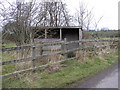
Bus shelter at Aghnagar, Sixmilecross
It looks more like a birdwatcher's hut..
Image: © Kenneth Allen
Taken: 6 Mar 2006
0.13 miles
3
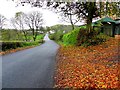
Fallen leaves, Altamuskin Road
Heading south-east at Aghnagar
Image: © Kenneth Allen
Taken: 6 Nov 2012
0.14 miles
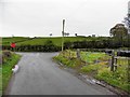
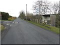
4
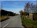
Altamuskin Road, Altamuskin
Heading north-west
Image: © Kenneth Allen
Taken: 11 Mar 2014
0.14 miles
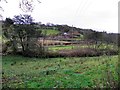
5
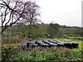
Silage bales, Aghnagar
Pictured along Altamuskin Road
Image: © Kenneth Allen
Taken: 6 Nov 2012
0.15 miles
6
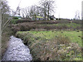
Foremass Townland
The Cloughfin River in its early stage
Image: © Kenneth Allen
Taken: 6 Mar 2006
0.15 miles
7
Caldragh Road, Aghnagar
Heading north from Altamuskin Road
Image: © Kenneth Allen
Taken: 6 Nov 2012
0.15 miles
9
Altamuskin Road, Altamuskin
Heading north-west towards Sixmilecross
To the left is Image]
Image: © Kenneth Allen
Taken: 16 Mar 2013
0.15 miles