IMAGES TAKEN NEAR TO
Foremass Road, OMAGH, BT79 9DT
Introduction
This page details the photographs taken nearby to Foremass Road, BT79 9DT by members of the Geograph project.
The Geograph project started in 2005 with the aim of publishing, organising and preserving representative images for every square kilometre of Great Britain, Ireland and the Isle of Man.

There are currently over 7.5m images from over14,400 individuals and you can help contribute to the project by visiting https://www.geograph.org.uk
Image Map
Images are licensed for reuse under creativecommons.org/licenses/by-sa/2.0
Notes
- Clicking on the map will re-center to the selected point.
- The higher the marker number, the further away the image location is from the centre of the postcode.
Image Listing (14 Images Found)
Images are licensed for reuse under creativecommons.org/licenses/by-sa/2.0
Image
Details
Distance
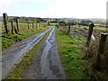
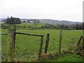
1
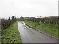
Foremass Road, Foremass Upper
Heading west
Image: © Kenneth Allen
Taken: 30 Jan 2012
0.03 miles
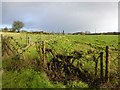
2
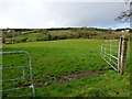
An open field, Foremass Upper
Looking north-west
Image: © Kenneth Allen
Taken: 30 Jan 2013
0.04 miles
3
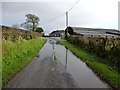
Flooding along Foremass Road
Heading eastwards
Image: © Kenneth Allen
Taken: 30 Jan 2013
0.04 miles
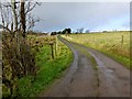
4
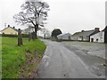
Foremass Road
Heading east on a cold wet day.
Image: © Kenneth Allen
Taken: 30 Jan 2012
0.05 miles
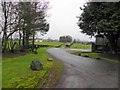
5
Rough lane, Foremass Upper
Heading south-east towards Foremass Road
Image: © Kenneth Allen
Taken: 30 Jan 2013
0.06 miles
6
Foremass Road
Looking east at Foremass upper
Image: © Kenneth Allen
Taken: 30 Jan 2012
0.07 miles
9
Foremass Upper
Looking south-west in the direction of Altamooskan
Image: © Kenneth Allen
Taken: 30 Jan 2012
0.09 miles
10
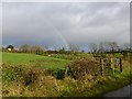
Rainbow, Foremass Upper
Viewed along Foremass Road
Image: © Kenneth Allen
Taken: 30 Jan 2013
0.10 miles