IMAGES TAKEN NEAR TO
Carrick Hill, OMAGH, BT79 9DD
Introduction
This page details the photographs taken nearby to Carrick Hill, BT79 9DD by members of the Geograph project.
The Geograph project started in 2005 with the aim of publishing, organising and preserving representative images for every square kilometre of Great Britain, Ireland and the Isle of Man.

There are currently over 7.5m images from over14,400 individuals and you can help contribute to the project by visiting https://www.geograph.org.uk
Image Map
Images are licensed for reuse under creativecommons.org/licenses/by-sa/2.0
Notes
- Clicking on the map will re-center to the selected point.
- The higher the marker number, the further away the image location is from the centre of the postcode.
Image Listing (60 Images Found)
Images are licensed for reuse under creativecommons.org/licenses/by-sa/2.0
Image
Details
Distance
1
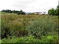
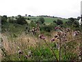
Rushy ground, Carrickmore
Pictured along Mullanmore Road
Image: © Kenneth Allen
Taken: 20 Aug 2013
0.02 miles
2
Drumnakilly Road, Carrickmore
Heading WNW towards Omagh
Image: © Kenneth Allen
Taken: 21 Jul 2010
0.08 miles
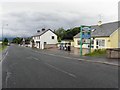
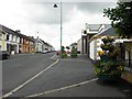
3
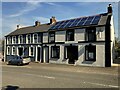
Main Street, Carrickmore
Heading north-west towards Omagh
Image: © Kenneth Allen
Taken: 21 Apr 2022
0.12 miles
4
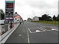
B4, Termon Road
Heading ESE in Carrickmore
Image: © Kenneth Allen
Taken: 20 Aug 2013
0.14 miles
5
Rough ground, Mullanbeg
Looking ESE in the direction of Carrickmore
Image: © Kenneth Allen
Taken: 20 Aug 2013
0.14 miles
6
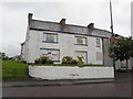
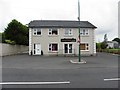
Building Carrickmore
It is located on the main street
Image: © Kenneth Allen
Taken: 21 Jul 2010
0.14 miles
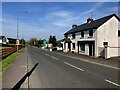
7
B4 Main Street, Carrickmore
Looking north-west
Image: © Kenneth Allen
Taken: 24 Jun 2013
0.14 miles
8
Aisling's Textile Studio, Carrickmore
It is located at Main Street
Image: © Kenneth Allen
Taken: 21 Jul 2010
0.15 miles
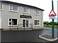
9
Impressions, Carrickmore
Located along Main Street
Image: © Kenneth Allen
Taken: 21 Apr 2022
0.16 miles
10
Aisling's Textile Studio, Carrickmore
Pictured along Termon Road
Image: © Kenneth Allen
Taken: 20 Aug 2013
0.17 miles