IMAGES TAKEN NEAR TO
Carn Road, OMAGH, BT79 8LA
Introduction
This page details the photographs taken nearby to Carn Road, BT79 8LA by members of the Geograph project.
The Geograph project started in 2005 with the aim of publishing, organising and preserving representative images for every square kilometre of Great Britain, Ireland and the Isle of Man.

There are currently over 7.5m images from over14,400 individuals and you can help contribute to the project by visiting https://www.geograph.org.uk
Image Map
Images are licensed for reuse under creativecommons.org/licenses/by-sa/2.0
Notes
- Clicking on the map will re-center to the selected point.
- The higher the marker number, the further away the image location is from the centre of the postcode.
Image Listing (14 Images Found)
Images are licensed for reuse under creativecommons.org/licenses/by-sa/2.0
Image
Details
Distance
1
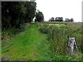
A grassy lane, Learden Lower
Pictured along Carn Road
Image: © Kenneth Allen
Taken: 13 Aug 2013
0.02 miles
2
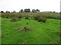
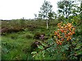
Rushy ground, Learden Lower
Pictured along Carn Road
Image: © Kenneth Allen
Taken: 13 Aug 2013
0.05 miles
3
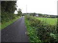
Carn Road
Heading ENE at Learden Lower
Image: © Kenneth Allen
Taken: 13 Aug 2013
0.05 miles
4
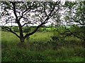
Tree, Learden Lower
Pictured along Carn Road
Image: © Kenneth Allen
Taken: 13 Aug 2013
0.09 miles
6
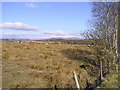
Learden Upper Townland
The ground seems to be very dry here.
Image: © Kenneth Allen
Taken: 25 Feb 2006
0.10 miles
7
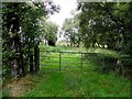
Gate, Learden Lower
Pictured along Carn Road
Image: © Kenneth Allen
Taken: 13 Aug 2013
0.14 miles
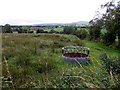
8
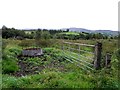
Feeder and a rushy field, Learden Lower
Pictured along Carn Road
Image: © Kenneth Allen
Taken: 13 Aug 2013
0.16 miles
9
Animal feeder, Learden Lower
Pictured along Carn Road
Image: © Kenneth Allen
Taken: 13 Aug 2013
0.17 miles
10
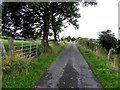
Carn Road, Learden Lower
Heading ENE
Image: © Kenneth Allen
Taken: 13 Aug 2013
0.19 miles