IMAGES TAKEN NEAR TO
Meenagorp Road, OMAGH, BT79 8DP
Introduction
This page details the photographs taken nearby to Meenagorp Road, BT79 8DP by members of the Geograph project.
The Geograph project started in 2005 with the aim of publishing, organising and preserving representative images for every square kilometre of Great Britain, Ireland and the Isle of Man.

There are currently over 7.5m images from over14,400 individuals and you can help contribute to the project by visiting https://www.geograph.org.uk
Image Map
Images are licensed for reuse under creativecommons.org/licenses/by-sa/2.0
Notes
- Clicking on the map will re-center to the selected point.
- The higher the marker number, the further away the image location is from the centre of the postcode.
Image Listing (9 Images Found)
Images are licensed for reuse under creativecommons.org/licenses/by-sa/2.0
Image
Details
Distance
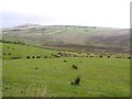
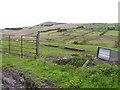
1
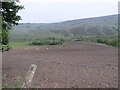
Meenagarragh Townland
Crockaclady mountain is to the distant right.
Image: © Kenneth Allen
Taken: 4 Jul 2006
0.10 miles
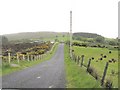
2
Craigatuke Mountain
Looking up the hill
Image: © Kenneth Allen
Taken: 4 Jul 2006
0.11 miles
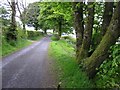
3
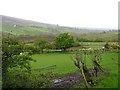
Meenagarragh Townland
Looking south-east
Image: © Kenneth Allen
Taken: 21 May 2009
0.16 miles
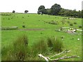
5
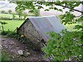
Farm Shed, Meenagarragh
Viewed along the Maanagorp Road
Image: © Kenneth Allen
Taken: 21 May 2009
0.18 miles
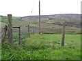
8
Meenagarragh Townland
Looking north-east
Image: © Kenneth Allen
Taken: 21 May 2009
0.21 miles
9
Craigatuke Townland
Looking north-east
Image: © Kenneth Allen
Taken: 21 May 2009
0.22 miles