IMAGES TAKEN NEAR TO
Glenelly Road, OMAGH, BT79 8BN
Introduction
This page details the photographs taken nearby to Glenelly Road, BT79 8BN by members of the Geograph project.
The Geograph project started in 2005 with the aim of publishing, organising and preserving representative images for every square kilometre of Great Britain, Ireland and the Isle of Man.

There are currently over 7.5m images from over14,400 individuals and you can help contribute to the project by visiting https://www.geograph.org.uk
Image Map
Images are licensed for reuse under creativecommons.org/licenses/by-sa/2.0
Notes
- Clicking on the map will re-center to the selected point.
- The higher the marker number, the further away the image location is from the centre of the postcode.
Image Listing (27 Images Found)
Images are licensed for reuse under creativecommons.org/licenses/by-sa/2.0
Image
Details
Distance
1
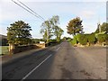
Castledamph Road
Heading west towards Plumbridge
Image: © Kenneth Allen
Taken: 16 Oct 2010
0.02 miles
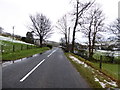
2
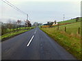
Glenelly Road
Heading west from Eden Back
Image: © Kenneth Allen
Taken: 19 Jan 2016
0.03 miles
3
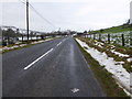
Glenelly Road
Heading west at Eden Back
Image: © Kenneth Allen
Taken: 22 Jan 2018
0.03 miles
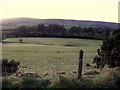
4
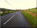
B47 Glenelly Road, Eden Back
Heading west
Image: © Kenneth Allen
Taken: 30 Dec 2014
0.05 miles
5
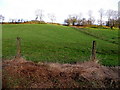
Hilly ground, Eden Back
Pictured along Glenelly Road
Image: © Kenneth Allen
Taken: 30 Dec 2014
0.07 miles
6
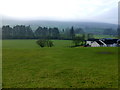
Along the Glenelly Valley
Looking south-west at Eden Back
Image: © Kenneth Allen
Taken: 19 Jan 2016
0.08 miles
7
Glenelly Road, Eden Back
Heading east
Image: © Kenneth Allen
Taken: 22 Jan 2018
0.09 miles
8
Frosty ground, Eden Back
The Slievwmore Mountain is obstructing the sun's rays at the Glenelly Valley
Image: © Kenneth Allen
Taken: 30 Dec 2014
0.09 miles
9
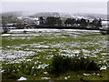
Snow, Eden Back
Looking south from Glenelly Road
Image: © Kenneth Allen
Taken: 22 Jan 2018
0.09 miles
10
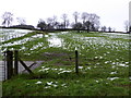
Snow, Eden Back
Pictured along Glenelly Road
Image: © Kenneth Allen
Taken: 22 Jan 2018
0.10 miles