
IMAGES TAKEN NEAR TO
Glenelly Road, OMAGH, BT79 8BG
Introduction
This page details the photographs taken nearby to Glenelly Road, BT79 8BG by members of the Geograph project.
The Geograph project started in 2005 with the aim of publishing, organising and preserving representative images for every square kilometre of Great Britain, Ireland and the Isle of Man.

There are currently over 7.5m images from over14,400 individuals and you can help contribute to the project by visiting https://www.geograph.org.uk
Image Map
Images are licensed for reuse under creativecommons.org/licenses/by-sa/2.0
Notes
- Clicking on the map will re-center to the selected point.
- The higher the marker number, the further away the image location is from the centre of the postcode.
Image Listing (14 Images Found)
Images are licensed for reuse under creativecommons.org/licenses/by-sa/2.0
Image
Details
Distance
1
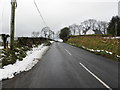
Glenelly Road, Aghalane
Heading west to Plumbridge
Image: © Kenneth Allen
Taken: 3 Feb 2015
0.10 miles
2
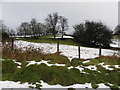
Snow, Aghalane
Pictured along Glenelly Road
Image: © Kenneth Allen
Taken: 3 Feb 2015
0.11 miles
3
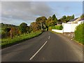
B47 Glenelly Road
Heading west towards Plumbridge
Image: © Kenneth Allen
Taken: 16 Oct 2010
0.12 miles
4
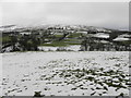
Wintry at the Glenelly Valley, Aghalane
Looking south from Glenelly Road
Image: © Kenneth Allen
Taken: 3 Feb 2015
0.15 miles
5
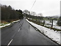
B47 Glenelly Road, Aghalane
Heading ENE towards Sperrin
Image: © Kenneth Allen
Taken: 3 Feb 2015
0.16 miles
6
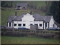
Aghalane Primary School
The Tyrone County Education Committee maintained this property around the 1970s. Being a maintenance officer, I had to do periodic visits to the schools in the area that I was responsible for getting work carried out. A country school like this rarely was subjected to vandalism like some of the town schools, the occasional broken pane of glass and blocked sewer from the potato peeler was noted. I preferred to call at this wee school and stop for a meal, if business took me out over lunch time, as the cooking was of a high standard, even though the small kitchen was located in a narrow passageway in the centre of the school. The building was converted to a dwelling house after it closed. It is located along Glenelly Road and viewed from Landahussy Road Image]
Image: © Kenneth Allen
Taken: 15 Mar 2011
0.16 miles
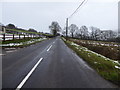
8
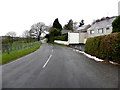
B47 Glenelly Road
Heading west towards Plumbridge at Aghalane
Image: © Kenneth Allen
Taken: 14 Feb 2014
0.20 miles
9
Glenelly Road
Heading west at Aghalane
Image: © Kenneth Allen
Taken: 22 Jan 2018
0.21 miles
10
Glenelly Cottages at Aughalane
Pictured along Glenelly Road
Aughalane is spelt as Aghalane on the townland map
Image: © Kenneth Allen
Taken: 14 Feb 2014
0.22 miles