IMAGES TAKEN NEAR TO
Gleannan Brae, OMAGH, BT79 7YB
Introduction
This page details the photographs taken nearby to Gleannan Brae, BT79 7YB by members of the Geograph project.
The Geograph project started in 2005 with the aim of publishing, organising and preserving representative images for every square kilometre of Great Britain, Ireland and the Isle of Man.

There are currently over 7.5m images from over14,400 individuals and you can help contribute to the project by visiting https://www.geograph.org.uk
Image Map
Images are licensed for reuse under creativecommons.org/licenses/by-sa/2.0
Notes
- Clicking on the map will re-center to the selected point.
- The higher the marker number, the further away the image location is from the centre of the postcode.
Image Listing (140 Images Found)
Images are licensed for reuse under creativecommons.org/licenses/by-sa/2.0
Image
Details
Distance
1
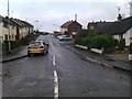
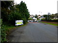
Mc Ivor Villas, Killyclogher
Looking north
Image: © Kenneth Allen
Taken: 7 Jan 2013
0.08 miles
2
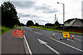
Killyclogher Road - closed and diversion signs
Pictured at Mullaghmore / Killyclogher
I heard later that there was a fatal road accident the previous evening further on in the direction of Mountfield
Image: © Kenneth Allen
Taken: 1 Aug 2022
0.10 miles
3
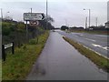
A505 Killyclogher Road, Killyclogher
Heading ENE towards Mountfield and Cookstown
The townland of Mullaghmore is on the right hand side of the road
Image: © Kenneth Allen
Taken: 7 Jan 2013
0.11 miles
4
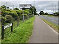
A505 Killyclogher Road, Mullaghmore
Heading ENE towards Cookstown
Image: © Kenneth Allen
Taken: 4 Jul 2022
0.12 miles
5
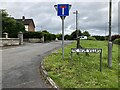
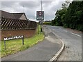
Farmhill Road, Mullaghmore
Heading NNW towards the village of Killyclogher
See close-up of notice board here Image]
Image: © Kenneth Allen
Taken: 21 Oct 2016
0.12 miles
6
McIvor Villas, Killyclogher, Omagh
Heading east from Old Mountfield Road
Image: © Kenneth Allen
Taken: 4 Jul 2022
0.12 miles
7
The wee-est house in Killyclogher
It is located along the Old Mountfield Road
Image: © Kenneth Allen
Taken: 5 Jan 2010
0.12 miles
8
Road at Mc Ivor Villas, Killyclogher
Heading west towards Old Mountfield Road
Image: © Kenneth Allen
Taken: 7 Jan 2013
0.12 miles
9
Farmhill Road, Mullaghmore, Omagh
Heading SSE from Killyclogher Road
Image: © Kenneth Allen
Taken: 4 Jul 2022
0.12 miles
10
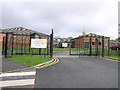
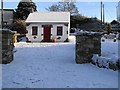
Saint Mary's Primary School, Killyclogher
St Mary's Primary School, (Local education authority: Western) is a Primary School in Killyclogher, Omagh. It replaces an old school and temporary classrooms. No different to most of the schools in the area, it has security fencing to protect the property.
Image: © Kenneth Allen
Taken: 24 Oct 2005
0.13 miles