IMAGES TAKEN NEAR TO
Gortnagarn Road, OMAGH, BT79 7SW
Introduction
This page details the photographs taken nearby to Gortnagarn Road, BT79 7SW by members of the Geograph project.
The Geograph project started in 2005 with the aim of publishing, organising and preserving representative images for every square kilometre of Great Britain, Ireland and the Isle of Man.

There are currently over 7.5m images from over14,400 individuals and you can help contribute to the project by visiting https://www.geograph.org.uk
Image Map
Images are licensed for reuse under creativecommons.org/licenses/by-sa/2.0
Notes
- Clicking on the map will re-center to the selected point.
- The higher the marker number, the further away the image location is from the centre of the postcode.
Image Listing (30 Images Found)
Images are licensed for reuse under creativecommons.org/licenses/by-sa/2.0
Image
Details
Distance
1
Pothole along Gortnagarn Road
Heading north-west at Mountjoy Forest east Division
Image: © Kenneth Allen
Taken: 17 Feb 2021
0.03 miles
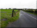
2
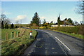
Gortnagarn Road
Heading north-west to join the Derry Road
Image: © Kenneth Allen
Taken: 20 Aug 2009
0.03 miles
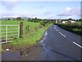
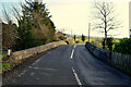
4
Gortnagarn Road, Mountjoy Forest East Division
Heading NNW
Image: © Kenneth Allen
Taken: 13 Jan 2015
0.05 miles
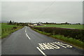
5
Gortnagarn Road
Heading NNW at Mountjoy Forest West Division
Image: © Kenneth Allen
Taken: 21 Aug 2014
0.06 miles
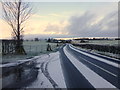
6
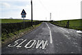
Slow markings along Gortnagarn Road
Heading south-east at Mountjoy Forest East Division
Image: © Kenneth Allen
Taken: 17 Feb 2021
0.06 miles
7
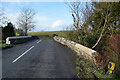
Bridge along Gortnagarn Road
It spans Carnony Burn
Image: © Kenneth Allen
Taken: 17 Feb 2021
0.06 miles
8
Gortnagarn Road, Mountjoy Forest East Division
Heading NNW
Image: © Kenneth Allen
Taken: 12 Feb 2019
0.06 miles
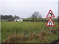
9
Knockmoyle Bridge, Mountjoy Forest East Division
Pictured along Gortnagarn Road
Image: © Kenneth Allen
Taken: 17 Feb 2021
0.07 miles
10
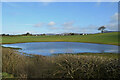
Flood in field, Mountjoy Forest East Division
Looks pretty but the land owner is making a drain to clear it
Image: © Kenneth Allen
Taken: 17 Feb 2021
0.07 miles