IMAGES TAKEN NEAR TO
Mullydoo Road, OMAGH, BT79 7RX
Introduction
This page details the photographs taken nearby to Mullydoo Road, BT79 7RX by members of the Geograph project.
The Geograph project started in 2005 with the aim of publishing, organising and preserving representative images for every square kilometre of Great Britain, Ireland and the Isle of Man.

There are currently over 7.5m images from over14,400 individuals and you can help contribute to the project by visiting https://www.geograph.org.uk
Image Map
Images are licensed for reuse under creativecommons.org/licenses/by-sa/2.0
Notes
- Clicking on the map will re-center to the selected point.
- The higher the marker number, the further away the image location is from the centre of the postcode.
Image Listing (23 Images Found)
Images are licensed for reuse under creativecommons.org/licenses/by-sa/2.0
Image
Details
Distance
1
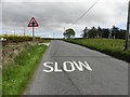
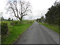
Sheskinshule Townland
Pictured along Mullydoo Road
Image: © Kenneth Allen
Taken: 24 May 2013
0.02 miles
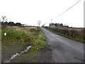
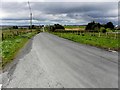
2
Mullydoo Road
Heading WNW towards Crockanboy
Image: © Kenneth Allen
Taken: 24 May 2013
0.07 miles
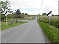
3
Mullydoo Road, Sheskinshule
Heading WNW
Image: © Kenneth Allen
Taken: 24 May 2013
0.08 miles
4
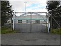
Entrance, Greencastle GAA Club
Pictured along Mullydoo Road
Image: © Kenneth Allen
Taken: 24 May 2013
0.10 miles
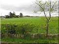
5
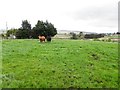
Cows, Sheskinshule
Pictured along Mullydoo Road
Image: © Kenneth Allen
Taken: 24 May 2013
0.10 miles
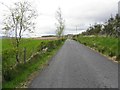
6
Mullydoo Road, Sheskinshule
Heading WNW from Greencastle Road
Image: © Kenneth Allen
Taken: 24 May 2013
0.13 miles
7
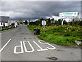
Greencastle Road, Sheskinshule
Heading south-west and look at that sky!
Fortunately it didn't rain, but the wind was cold
Image: © Kenneth Allen
Taken: 24 May 2013
0.14 miles
8
Greencastle Road, Sheskinshule
Heading north-east
Image: © Kenneth Allen
Taken: 24 May 2013
0.14 miles