IMAGES TAKEN NEAR TO
Crockanboy Road, OMAGH, BT79 7RL
Introduction
This page details the photographs taken nearby to Crockanboy Road, BT79 7RL by members of the Geograph project.
The Geograph project started in 2005 with the aim of publishing, organising and preserving representative images for every square kilometre of Great Britain, Ireland and the Isle of Man.

There are currently over 7.5m images from over14,400 individuals and you can help contribute to the project by visiting https://www.geograph.org.uk
Image Map
Images are licensed for reuse under creativecommons.org/licenses/by-sa/2.0
Notes
- Clicking on the map will re-center to the selected point.
- The higher the marker number, the further away the image location is from the centre of the postcode.
Image Listing (17 Images Found)
Images are licensed for reuse under creativecommons.org/licenses/by-sa/2.0
Image
Details
Distance
1
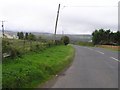
B46, Crockanboy Road
Heading WSW towards Gortin
Image: © Kenneth Allen
Taken: 13 Oct 2009
0.04 miles
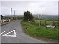
2
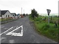
Bunivar Road, Glenmacoffer
Heading NNW from Crockanboy Road
The road sign which includes the townland name is missing - see previous image Image]
Image: © Kenneth Allen
Taken: 20 May 2013
0.08 miles
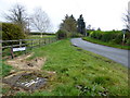
3
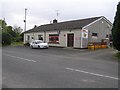
Post Office, Glenmacoffer
It is located along the Crockanboy Road
Image: © Kenneth Allen
Taken: 13 Oct 2009
0.09 miles
4
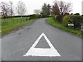
Glenmacoffer Road, Glenmacoffer
Heading south-east from Crockanboy Road
Image: © Kenneth Allen
Taken: 20 May 2013
0.10 miles
5
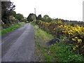
Whins along Glenmacoffer Road
Heading south-east
Image: © Kenneth Allen
Taken: 20 May 2013
0.10 miles
6
Glenmacoffer Road
Heading south-east from Crockanboy Road
Image: © Kenneth Allen
Taken: 1 Nov 2017
0.10 miles
7
Buninvar Road
Heading NNW at Glenmacoffer
Image: © Kenneth Allen
Taken: 13 Oct 2009
0.11 miles
8
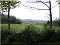
Glenmacoffer Townland
Looking WSW from Glenmacoffer road
Image: © Kenneth Allen
Taken: 20 May 2013
0.15 miles
9
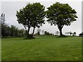
Trees, Glenmacoffer
Pictured along Glenmacoffer Road
Image: © Kenneth Allen
Taken: 20 May 2013
0.19 miles
10
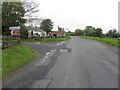
Crockanboy Road, Fallagh Lower
Heading west
Image: © Kenneth Allen
Taken: 20 May 2013
0.21 miles