IMAGES TAKEN NEAR TO
Fallagh Road, OMAGH, BT79 7QU
Introduction
This page details the photographs taken nearby to Fallagh Road, BT79 7QU by members of the Geograph project.
The Geograph project started in 2005 with the aim of publishing, organising and preserving representative images for every square kilometre of Great Britain, Ireland and the Isle of Man.

There are currently over 7.5m images from over14,400 individuals and you can help contribute to the project by visiting https://www.geograph.org.uk
Image Map
Images are licensed for reuse under creativecommons.org/licenses/by-sa/2.0
Notes
- Clicking on the map will re-center to the selected point.
- The higher the marker number, the further away the image location is from the centre of the postcode.
Image Listing (37 Images Found)
Images are licensed for reuse under creativecommons.org/licenses/by-sa/2.0
Image
Details
Distance
1
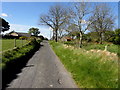
Fallagh Road, Aghnamirigan
Heading south-west
Image: © Kenneth Allen
Taken: 5 May 2017
0.02 miles
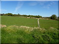
2
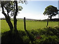
Aghnamirigan Townland
Looking south-east from Fallagh Road
Image: © Kenneth Allen
Taken: 5 May 2017
0.02 miles
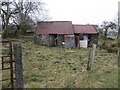
3
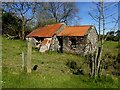
Ruined farm dwelling, Aghnamirigan
Pictured along Fallagh Road
Image: © Kenneth Allen
Taken: 5 May 2017
0.03 miles
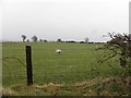
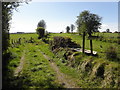
5
Grass verge, Aghnamirigan
Pictured along Lenagh Road
Image: © Kenneth Allen
Taken: 5 May 2017
0.04 miles
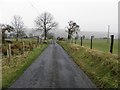
6
Aghnamirigan Townland
Pictured along Fallagh Road
Image: © Kenneth Allen
Taken: 23 Apr 2013
0.07 miles
7
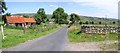
Road at Fallaght Upper
The road is heading north-east
Image: © Kenneth Allen
Taken: 14 Jul 2006
0.07 miles
8
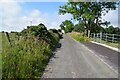
Fallagh Road, Aghnamerigan
Heading south-west
Image: © Kenneth Allen
Taken: 15 Jul 2024
0.09 miles
9
Ruined farm building, Aghnamirigan
Pictured along Fallagh Road
Image: © Kenneth Allen
Taken: 23 Apr 2013
0.11 miles
10
Short lane, Aghnamirigan
Heading SSE from Fallagh Road
Image: © Kenneth Allen
Taken: 5 May 2017
0.11 miles