IMAGES TAKEN NEAR TO
Aghaboy Road, OMAGH, BT79 7QS
Introduction
This page details the photographs taken nearby to Aghaboy Road, BT79 7QS by members of the Geograph project.
The Geograph project started in 2005 with the aim of publishing, organising and preserving representative images for every square kilometre of Great Britain, Ireland and the Isle of Man.

There are currently over 7.5m images from over14,400 individuals and you can help contribute to the project by visiting https://www.geograph.org.uk
Image Map
Images are licensed for reuse under creativecommons.org/licenses/by-sa/2.0
Notes
- Clicking on the map will re-center to the selected point.
- The higher the marker number, the further away the image location is from the centre of the postcode.
Image Listing (55 Images Found)
Images are licensed for reuse under creativecommons.org/licenses/by-sa/2.0
Image
Details
Distance
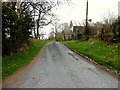
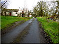
1
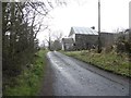
Aghaboy Road, Binnafreaghan
Heading ESE
Image: © Kenneth Allen
Taken: 15 Apr 2013
0.02 miles
2
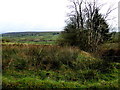
Rushy ground, Binnafreaghan
Pictured along Aghaboy Road
Image: © Kenneth Allen
Taken: 5 Apr 2017
0.03 miles
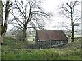
3
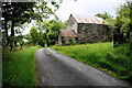
Ruined farm buildings along Aghaboy Road
Heading ESE
Image: © Kenneth Allen
Taken: 18 Jun 2019
0.03 miles
4
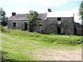
Abandoned dwelling at Aghnamirigan
Looking west.
Image: © Kenneth Allen
Taken: 14 Jul 2006
0.03 miles
6
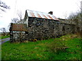
Stone walled barn, Binnafreaghan
Looking east
Image: © Kenneth Allen
Taken: 5 Apr 2017
0.04 miles
7
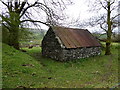
Stone walled hut, Binnafreaghan
In the distance I could see Image]
Image: © Kenneth Allen
Taken: 5 Apr 2017
0.04 miles
8
Aghaboy Road, Binnafreaghan
Heading ESE
Image: © Kenneth Allen
Taken: 18 Feb 2016
0.04 miles
9
Old farm building, Binnafreaghan
Pictured along Aghaboy Road
Image: © Kenneth Allen
Taken: 15 Apr 2013
0.04 miles
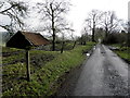
10
Ruined buildings, Binnafreaghan
Heading WNW on Aghaboy Road
Image: © Kenneth Allen
Taken: 5 Apr 2017
0.05 miles