IMAGES TAKEN NEAR TO
Greencastle Road, OMAGH, BT79 7QN
Introduction
This page details the photographs taken nearby to Greencastle Road, BT79 7QN by members of the Geograph project.
The Geograph project started in 2005 with the aim of publishing, organising and preserving representative images for every square kilometre of Great Britain, Ireland and the Isle of Man.

There are currently over 7.5m images from over14,400 individuals and you can help contribute to the project by visiting https://www.geograph.org.uk
Image Map
Images are licensed for reuse under creativecommons.org/licenses/by-sa/2.0
Notes
- Clicking on the map will re-center to the selected point.
- The higher the marker number, the further away the image location is from the centre of the postcode.
Image Listing (13 Images Found)
Images are licensed for reuse under creativecommons.org/licenses/by-sa/2.0
Image
Details
Distance
1
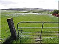
Gate, Crockanboy
Pictured along Greencastle Road
Image: © Kenneth Allen
Taken: 24 May 2013
0.04 miles
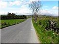
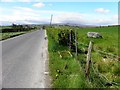
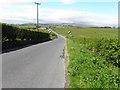
2
Greencastle Road, Crockanboy
Heading WSW
Image: © Kenneth Allen
Taken: 24 May 2013
0.04 miles
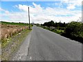
3
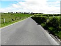
Greencastle Road
Heading ENE from Crockanboy towards Sheskinshule
Image: © Kenneth Allen
Taken: 24 May 2013
0.06 miles
4
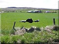
Plastic bag in tatters, Crockanboy
Pictured on a wire fence along Greencastle Road
Image: © Kenneth Allen
Taken: 24 May 2013
0.06 miles
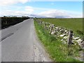
5
Greencastle Road, Crockanboy
Heading WSW
Image: © Kenneth Allen
Taken: 24 May 2013
0.09 miles
6
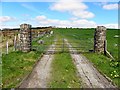
Stone pillars and gate, Crockanboy
Pictured along Greencastle Road, they're prefabricated!
Image: © Kenneth Allen
Taken: 24 May 2013
0.13 miles
7
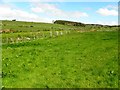
Crockanboy Townland
Looking NNW from Greencastle Road
Image: © Kenneth Allen
Taken: 24 May 2013
0.13 miles
8
Greencastle Road, Sheskinshule
Heading WSW
Image: © Kenneth Allen
Taken: 24 May 2013
0.15 miles
9
Greencastle Road, Crockanboy
Heading ENE towards Greencastle
Image: © Kenneth Allen
Taken: 24 May 2013
0.18 miles