IMAGES TAKEN NEAR TO
Arleston Road, OMAGH, BT79 7LH
Introduction
This page details the photographs taken nearby to Arleston Road, BT79 7LH by members of the Geograph project.
The Geograph project started in 2005 with the aim of publishing, organising and preserving representative images for every square kilometre of Great Britain, Ireland and the Isle of Man.

There are currently over 7.5m images from over14,400 individuals and you can help contribute to the project by visiting https://www.geograph.org.uk
Image Map
Images are licensed for reuse under creativecommons.org/licenses/by-sa/2.0
Notes
- Clicking on the map will re-center to the selected point.
- The higher the marker number, the further away the image location is from the centre of the postcode.
Image Listing (324 Images Found)
Images are licensed for reuse under creativecommons.org/licenses/by-sa/2.0
Image
Details
Distance
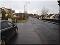
1
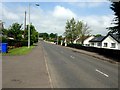
Arleston Road, Omagh
Heading north-west towards Old Mountfield Road
Image: © Kenneth Allen
Taken: 8 Jun 2016
0.02 miles
2
Arlesron Park, Omagh
Pictured along Arleston Road
Image: © Kenneth Allen
Taken: 23 May 2013
0.03 miles
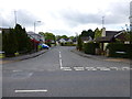
3
Arleston Park, Omagh
It is off Arleston Road
Image: © Kenneth Allen
Taken: 10 Jul 2006
0.04 miles
4
Arleston Park, Omagh
Pictured along Arleston Road
Image: © Kenneth Allen
Taken: 29 Jan 2015
0.04 miles
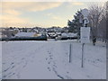
5
Arleston Road, Omagh
Heading north-west to Old Mountfield Road
Image: © Kenneth Allen
Taken: 25 Jan 2018
0.06 miles
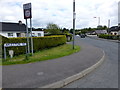
7
Arleston Road, Mullaghmore, Omagh
Heading ESE from Old Mountfield Road
Image: © Kenneth Allen
Taken: 4 Jul 2022
0.06 miles
8
Arleston Road, Omagh
Heading south-east from Old Mountfield Road
Image: © Kenneth Allen
Taken: 23 May 2013
0.07 miles
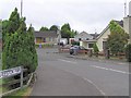
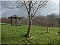
9
Arleston Park, Omagh
Looking east in the direction of Arleston Park
Image: © Kenneth Allen
Taken: 29 Jan 2015
0.07 miles
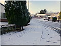
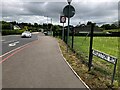
10
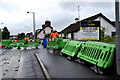
Moving barriers, Old Mountfield Road
Pictured at Mullaghmore
Image: © Kenneth Allen
Taken: 2 Aug 2018
0.08 miles