IMAGES TAKEN NEAR TO
Corran Road, OMAGH, BT79 7JW
Introduction
This page details the photographs taken nearby to Corran Road, BT79 7JW by members of the Geograph project.
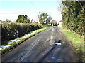
The Geograph project started in 2005 with the aim of publishing, organising and preserving representative images for every square kilometre of Great Britain, Ireland and the Isle of Man.

There are currently over 7.5m images from over14,400 individuals and you can help contribute to the project by visiting https://www.geograph.org.uk
Image Map
Images are licensed for reuse under creativecommons.org/licenses/by-sa/2.0
Notes
- Clicking on the map will re-center to the selected point.
- The higher the marker number, the further away the image location is from the centre of the postcode.
Image Listing (46 Images Found)
Images are licensed for reuse under creativecommons.org/licenses/by-sa/2.0
Image
Details
Distance
1
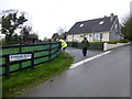
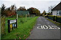
Former school, Corranarry
Located along Corran Road
Now a dwelling
Image: © Kenneth Allen
Taken: 24 Apr 2018
0.01 miles
2
Corran Road, Corranarry
Heading NNE from the intersection with Glenderg Road
Image: © Kenneth Allen
Taken: 26 Jul 2021
0.01 miles
3
Corran Road, Corranarry
Heading north-east
Image: © Kenneth Allen
Taken: 13 Feb 2018
0.01 miles
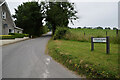
4
Corran Road
Heading NNE at Corranarry
Image: © Kenneth Allen
Taken: 25 Feb 2009
0.01 miles
5
Glenderg Road, Corranarry
Heading NNW from the junction with Corran Road
Image: © Kenneth Allen
Taken: 6 Nov 2024
0.01 miles
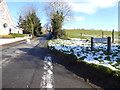
6
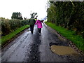
A very nasty pothole along Glenderg Road
Heading NNW on Glenderg Road
Image: © Kenneth Allen
Taken: 24 Apr 2018
0.01 miles
7
Corran Road
Heading NNE at Corranarry
Image: © Kenneth Allen
Taken: 26 Feb 2013
0.01 miles
8
Glenderg Road
Heading NNW at Corranarry
Image: © Kenneth Allen
Taken: 26 Feb 2013
0.02 miles
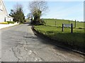
9
Glenderg Road, Corranarry
Heading north-west to Corran Road
Image: © Kenneth Allen
Taken: 13 Feb 2018
0.02 miles
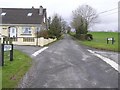
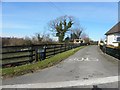
10
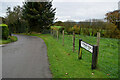
Corran Road, Corranarry
Heading SSW from the junction with Glenderg Road
Image: © Kenneth Allen
Taken: 6 Nov 2024
0.03 miles