IMAGES TAKEN NEAR TO
Curr Road, OMAGH, BT79 0UP
Introduction
This page details the photographs taken nearby to Curr Road, BT79 0UP by members of the Geograph project.
The Geograph project started in 2005 with the aim of publishing, organising and preserving representative images for every square kilometre of Great Britain, Ireland and the Isle of Man.

There are currently over 7.5m images from over14,400 individuals and you can help contribute to the project by visiting https://www.geograph.org.uk
Image Map
Images are licensed for reuse under creativecommons.org/licenses/by-sa/2.0
Notes
- Clicking on the map will re-center to the selected point.
- The higher the marker number, the further away the image location is from the centre of the postcode.
Image Listing (129 Images Found)
Images are licensed for reuse under creativecommons.org/licenses/by-sa/2.0
Image
Details
Distance
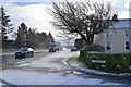
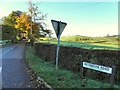
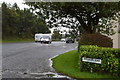
2
A5 Curr Road
Heading north-west at Gortaclare
Image: © Kenneth Allen
Taken: 6 Oct 2021
0.01 miles
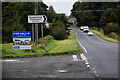
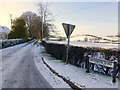
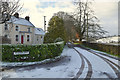
3
Meenmore Road, Gortaclare
Heading south-west from Curr Road
Image: © Kenneth Allen
Taken: 5 Jan 2023
0.01 miles
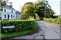
4
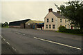
Shop closed at Gortaclare
Pictured along Curr Road
Image: © Kenneth Allen
Taken: 6 Oct 2021
0.01 miles
5
Meenmore Road, Gortaclare
Heading SSW from Curr Road
Image: © Kenneth Allen
Taken: 1 Nov 2012
0.01 miles
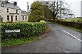
6
Meenmore Road, Gortaclare
Heading SSW from the A5
Image: © Kenneth Allen
Taken: 15 Jan 2016
0.01 miles
7
Meenmore Road
Heading south-west from Curr Road
Image: © Kenneth Allen
Taken: 14 May 2018
0.01 miles
8
Meenmore Road, Gortaclare
Heading SSW from A5 Curr Road
Image: © Kenneth Allen
Taken: 28 Sep 2018
0.01 miles
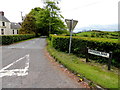
9
Curr Road, Gortaclare
Looking south-east from the junction with Meenmore Road
Image: © Kenneth Allen
Taken: 15 Oct 2019
0.01 miles
10
Meenmore Road, Gortaclare
Heading south-west from the A5
Image: © Kenneth Allen
Taken: 12 Feb 2020
0.01 miles