IMAGES TAKEN NEAR TO
Dervaghroy Drive, OMAGH, BT79 0UE
Introduction
This page details the photographs taken nearby to Dervaghroy Drive, BT79 0UE by members of the Geograph project.
The Geograph project started in 2005 with the aim of publishing, organising and preserving representative images for every square kilometre of Great Britain, Ireland and the Isle of Man.

There are currently over 7.5m images from over14,400 individuals and you can help contribute to the project by visiting https://www.geograph.org.uk
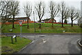
Image Map
Images are licensed for reuse under creativecommons.org/licenses/by-sa/2.0
Notes
- Clicking on the map will re-center to the selected point.
- The higher the marker number, the further away the image location is from the centre of the postcode.
Image Listing (73 Images Found)
Images are licensed for reuse under creativecommons.org/licenses/by-sa/2.0
Image
Details
Distance
1
Dervaghroy Road
Heading ESE at Clogherny Glebe Lower / Laragh
Image: © Kenneth Allen
Taken: 24 Jun 2020
0.02 miles
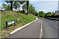
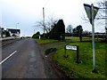
2
Dervaghroy Road
Heading WSW at Laragh
Image: © Kenneth Allen
Taken: 24 Jun 2020
0.02 miles
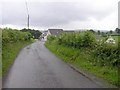
3
Dervaghroy Road, Clogherny Glebe Lower
Heading ESE
Image: © Kenneth Allen
Taken: 12 Oct 2012
0.03 miles
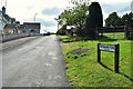
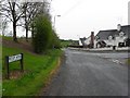
4
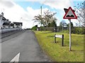
Road junction at Laragh / Clogherny Glebe Lower
The junction of Deverney Road and Rectory Avenue
Image: © Kenneth Allen
Taken: 15 Mar 2021
0.03 miles
5
Dervaghroy Road, Laragh
Heading WSW from Rectory Avenue
Image: © Kenneth Allen
Taken: 23 Jan 2017
0.03 miles
7
Rectory Avenue, Clogherny Glebe Lower
Heading south-east
Image: © Kenneth Allen
Taken: 27 Apr 2010
0.04 miles
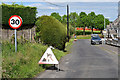
8
Dervaghroy Road, Beragh
Heading south-west
Image: © Kenneth Allen
Taken: 12 Oct 2012
0.04 miles
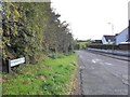
9
Hedge trimming along Dervaghroy Road
Pictured at Laragh
Image: © Kenneth Allen
Taken: 24 Jun 2020
0.04 miles