IMAGES TAKEN NEAR TO
Patricks Road, OMAGH, BT79 0SW
Introduction
This page details the photographs taken nearby to Patricks Road, BT79 0SW by members of the Geograph project.
The Geograph project started in 2005 with the aim of publishing, organising and preserving representative images for every square kilometre of Great Britain, Ireland and the Isle of Man.

There are currently over 7.5m images from over14,400 individuals and you can help contribute to the project by visiting https://www.geograph.org.uk
Image Map
Images are licensed for reuse under creativecommons.org/licenses/by-sa/2.0
Notes
- Clicking on the map will re-center to the selected point.
- The higher the marker number, the further away the image location is from the centre of the postcode.
Image Listing (31 Images Found)
Images are licensed for reuse under creativecommons.org/licenses/by-sa/2.0
Image
Details
Distance
1
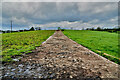
Concrete lane along a field, Derroar
A bit messy with cow poo
Image: © Kenneth Allen
Taken: 21 May 2022
0.09 miles
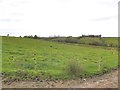
2
Lane to farm, Derroar
Pictured along Patricks Road
Image: © Kenneth Allen
Taken: 7 Apr 2021
0.09 miles
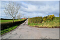
4
Patricks Road
Heading north to Derroar Road
Image: © Kenneth Allen
Taken: 24 Aug 2011
0.11 miles
5
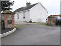
Crest Cottage
Located appropriately on the crest of a road at Derroar, outside Beragh village
Image: © Kenneth Allen
Taken: 8 Nov 2005
0.11 miles
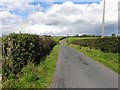
6
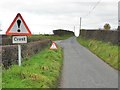
Crest ahead, Patricks Road
Further along is Image]
Image: © Kenneth Allen
Taken: 26 Oct 2012
0.11 miles
7
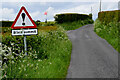
Blind summit sign along Patricks Road
Heading north at Derroar
Image: © Kenneth Allen
Taken: 21 May 2022
0.12 miles
8
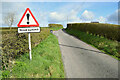
Blind summit sign, Derroar
Pictured along Patricks Road
Image: © Kenneth Allen
Taken: 7 Apr 2021
0.12 miles
9
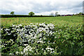
White thorn hedge, Derroar
Pictured along Patricks Road
Image: © Kenneth Allen
Taken: 21 May 2022
0.13 miles
10
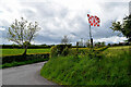
Tyrone flag, Derroar
Pictured along Patricks Road
Image: © Kenneth Allen
Taken: 21 May 2022
0.13 miles