IMAGES TAKEN NEAR TO
Loughmacrory Road, OMAGH, BT79 0PH
Introduction
This page details the photographs taken nearby to Loughmacrory Road, BT79 0PH by members of the Geograph project.
The Geograph project started in 2005 with the aim of publishing, organising and preserving representative images for every square kilometre of Great Britain, Ireland and the Isle of Man.

There are currently over 7.5m images from over14,400 individuals and you can help contribute to the project by visiting https://www.geograph.org.uk
Image Map
Images are licensed for reuse under creativecommons.org/licenses/by-sa/2.0
Notes
- Clicking on the map will re-center to the selected point.
- The higher the marker number, the further away the image location is from the centre of the postcode.
Image Listing (44 Images Found)
Images are licensed for reuse under creativecommons.org/licenses/by-sa/2.0
Image
Details
Distance
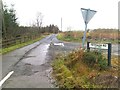
1
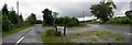
Fernagh Road / Loughmacrory Road
Looking WNW at Oxtown
Image: © Kenneth Allen
Taken: 21 Jul 2010
0.06 miles
2
Loughmacrory Road, Streefe Glebe
Heading WNW towards Mountfield
Image: © Kenneth Allen
Taken: 8 Nov 2012
0.09 miles
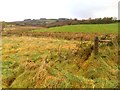
3
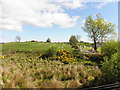
Rough ground, Oxtown
Pictured along Fernagh Road
Image: © Kenneth Allen
Taken: 10 Jun 2015
0.09 miles
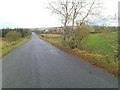
4
Fernagh Road, Oxtown
Heading west from Loughmacrory Road
Image: © Kenneth Allen
Taken: 10 Jun 2015
0.10 miles
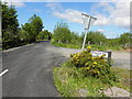
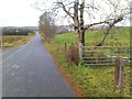
5
Fernagh Road
Heading west from Loughmacrory Road
Image: © Kenneth Allen
Taken: 8 Nov 2012
0.10 miles
7
Streefe Glebe
Looking north-east from Loughmacrory Road
Image: © Kenneth Allen
Taken: 8 Nov 2012
0.10 miles
8
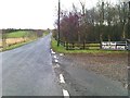
Loughmacrory Road, Oxtown
Heading ESE towards Loughmacrory
Image: © Kenneth Allen
Taken: 8 Nov 2012
0.10 miles
9
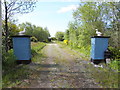
Entrance to fishing pond, Oxtown
Located off Loughmacrory Road
Image: © Kenneth Allen
Taken: 10 Jun 2015
0.11 miles
10
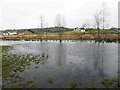
Wetland area, Oxtown
Pictured along Fernagh Road
Image: © Kenneth Allen
Taken: 19 Mar 2013
0.12 miles