IMAGES TAKEN NEAR TO
Crocknacor Road, OMAGH, BT79 0LY
Introduction
This page details the photographs taken nearby to Crocknacor Road, BT79 0LY by members of the Geograph project.
The Geograph project started in 2005 with the aim of publishing, organising and preserving representative images for every square kilometre of Great Britain, Ireland and the Isle of Man.

There are currently over 7.5m images from over14,400 individuals and you can help contribute to the project by visiting https://www.geograph.org.uk
Image Map
Images are licensed for reuse under creativecommons.org/licenses/by-sa/2.0
Notes
- Clicking on the map will re-center to the selected point.
- The higher the marker number, the further away the image location is from the centre of the postcode.
Image Listing (69 Images Found)
Images are licensed for reuse under creativecommons.org/licenses/by-sa/2.0
Image
Details
Distance
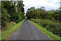
1
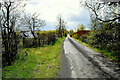
Crocknacor Road
Heading SSW at Cloghfin
Image: © Kenneth Allen
Taken: 5 May 2021
0.05 miles
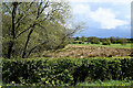
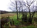
2
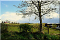
Bare tree, Cloghfin
Pictured along Crocknacor Road
Image: © Kenneth Allen
Taken: 5 May 2021
0.06 miles
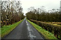
4
Crocknacor Road, Cloghfin
Heading NNE
Image: © Kenneth Allen
Taken: 23 Aug 2019
0.08 miles
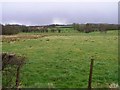
5
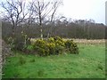
Rough ground, Cloghfin
Pictured along Crocknacor Road
Image: © Kenneth Allen
Taken: 5 May 2021
0.10 miles
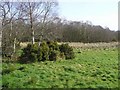
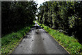
6
Well trimmed hedge along Crocknacor Road
Heading NNE at Cloghfin
Image: © Kenneth Allen
Taken: 16 Mar 2019
0.10 miles
7
Crocknacor Road
Heading SSW at Recarson
Image: © Kenneth Allen
Taken: 14 Sep 2023
0.11 miles
8
Cloghfin Townland
A storm approaches from the horizon to the north-east
Image: © Kenneth Allen
Taken: 26 Mar 2009
0.11 miles
9
Lisboy Townland
Looking ESE from Crocknacor Road
Image: © Kenneth Allen
Taken: 25 Jan 2014
0.12 miles