IMAGES TAKEN NEAR TO
Cloghan Road, OMAGH, BT79 0LF
Introduction
This page details the photographs taken nearby to Cloghan Road, BT79 0LF by members of the Geograph project.
The Geograph project started in 2005 with the aim of publishing, organising and preserving representative images for every square kilometre of Great Britain, Ireland and the Isle of Man.

There are currently over 7.5m images from over14,400 individuals and you can help contribute to the project by visiting https://www.geograph.org.uk
Image Map
Images are licensed for reuse under creativecommons.org/licenses/by-sa/2.0
Notes
- Clicking on the map will re-center to the selected point.
- The higher the marker number, the further away the image location is from the centre of the postcode.
Image Listing (212 Images Found)
Images are licensed for reuse under creativecommons.org/licenses/by-sa/2.0
Image
Details
Distance
1
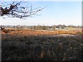
Rushy and frosty ground, Drumnakilly
Pictured along Cairn Road
Image: © Kenneth Allen
Taken: 18 Dec 2012
0.02 miles
2
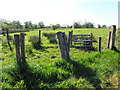
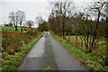
Drumnakilly Townland
Pictured along Cloghan Road
Image: © Kenneth Allen
Taken: 10 Jun 2015
0.03 miles
3
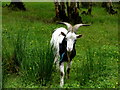
Curious goat, Drumnakilly
Pictured here Image]
Image: © Kenneth Allen
Taken: 11 Jul 2016
0.03 miles
4
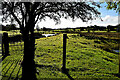
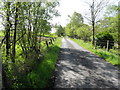
Drumnakilly Townland
Pictured along Cloghan Road
Image: © Kenneth Allen
Taken: 25 Oct 2023
0.03 miles
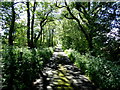
7
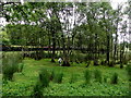
Copse, Drumnakilly
Coming towards me is a Image]
Image: © Kenneth Allen
Taken: 11 Jul 2016
0.04 miles
8
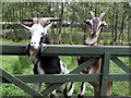
Goats, Drumnakilly
Pictured along Cloghan Road
Image: © Kenneth Allen
Taken: 11 Jul 2016
0.04 miles
9
Shady along Cairn Road
Heading SSE at Drumnakilly
Image: © Kenneth Allen
Taken: 2 Jun 2017
0.04 miles
10
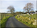
Cloghan Road
Looking south-west
My attention was drawn to Image]
Image: © Kenneth Allen
Taken: 27 Dec 2016
0.04 miles