IMAGES TAKEN NEAR TO
Orangefield Park, OMAGH, BT79 0DE
Introduction
This page details the photographs taken nearby to Orangefield Park, BT79 0DE by members of the Geograph project.
The Geograph project started in 2005 with the aim of publishing, organising and preserving representative images for every square kilometre of Great Britain, Ireland and the Isle of Man.

There are currently over 7.5m images from over14,400 individuals and you can help contribute to the project by visiting https://www.geograph.org.uk
Image Map
Images are licensed for reuse under creativecommons.org/licenses/by-sa/2.0
Notes
- Clicking on the map will re-center to the selected point.
- The higher the marker number, the further away the image location is from the centre of the postcode.
Image Listing (1628 Images Found)
Images are licensed for reuse under creativecommons.org/licenses/by-sa/2.0
Image
Details
Distance
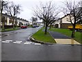
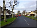
2
A bare tree, Orangefield Park, Omagh
Looking SSW
Image: © Kenneth Allen
Taken: 20 Oct 2014
0.01 miles
3
Fallen leaves, Orangefield Park, Omagh
Looking south
Image: © Kenneth Allen
Taken: 2 Nov 2015
0.01 miles
4
Frosty at Orangefield Park, Omagh
Heading SSW from Hospital Road
Image: © Kenneth Allen
Taken: 8 Jan 2021
0.01 miles
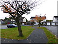
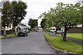
5
Orangefield Park, Omagh
Heading north to Hospital Road
Image: © Kenneth Allen
Taken: 18 Dec 2016
0.01 miles
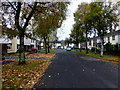
6
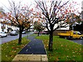
Autumnal at Orangefield Park, Omagh
Looking north
Image: © Kenneth Allen
Taken: 2 Nov 2013
0.01 miles
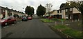
7
Orangefield Park, Omagh
Heading NNE towards Hospital Road
Image: © Kenneth Allen
Taken: 28 Jul 2020
0.01 miles
8
Orangefield Park, Omagh
Heading NNE to Hospital Road
Image: © Kenneth Allen
Taken: 26 Sep 2015
0.02 miles
9
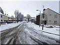
Snow and slush, Orangefield Park, Omagh
Looking SSW from Hospital Road
Image: © Kenneth Allen
Taken: 12 Feb 2018
0.02 miles
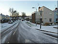
10
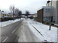
Snow, Orangefield Park, Omagh
Looking SSW from Hospital Road
Image: © Kenneth Allen
Taken: 1 Mar 2018
0.02 miles