IMAGES TAKEN NEAR TO
Shanmullagh Road, OMAGH, BT78 5QF
Introduction
This page details the photographs taken nearby to Shanmullagh Road, BT78 5QF by members of the Geograph project.
The Geograph project started in 2005 with the aim of publishing, organising and preserving representative images for every square kilometre of Great Britain, Ireland and the Isle of Man.

There are currently over 7.5m images from over14,400 individuals and you can help contribute to the project by visiting https://www.geograph.org.uk
Image Map
Images are licensed for reuse under creativecommons.org/licenses/by-sa/2.0
Notes
- Clicking on the map will re-center to the selected point.
- The higher the marker number, the further away the image location is from the centre of the postcode.
Image Listing (33 Images Found)
Images are licensed for reuse under creativecommons.org/licenses/by-sa/2.0
Image
Details
Distance
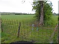
2
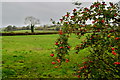
Rosehips, Kilmore
Looking south from Shanmullagh Road
Image: © Kenneth Allen
Taken: 9 Oct 2018
0.11 miles
3
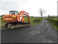
JCB, Kilmore
Pictured along a country lane
Image: © Kenneth Allen
Taken: 16 May 2012
0.12 miles
4
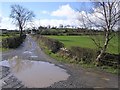
Lane, Mullanatoomog Townland
Looking SSW
Image: © Kenneth Allen
Taken: 10 Mar 2009
0.13 miles
5
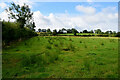
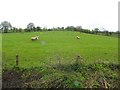
Kilmore Townland
Looking SSW from Shanmullagh Road
Image: © Kenneth Allen
Taken: 25 Aug 2022
0.14 miles
6
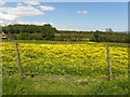
Field with buttercups, Kilmore
Pictured along Shanmullagh Road
Image: © Kenneth Allen
Taken: 11 Jun 2015
0.16 miles
7
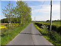
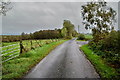
Shanmullagh Road, Kilmore
Heading ESE
Image: © Kenneth Allen
Taken: 11 Jun 2015
0.16 miles
8
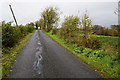
Cracks along Shanmullagh Road.Kilmore
Roads like these near bogs are prone to settlement
Image: © Kenneth Allen
Taken: 9 Oct 2018
0.17 miles
9
Kilmore Townland
A few spots of rain on the lens
Image: © Kenneth Allen
Taken: 16 May 2012
0.17 miles
10
Shanmullagh Road, Kilmore
Heading ESE
Image: © Kenneth Allen
Taken: 9 Oct 2018
0.17 miles