IMAGES TAKEN NEAR TO
Claragh Road, OMAGH, BT78 5QB
Introduction
This page details the photographs taken nearby to Claragh Road, BT78 5QB by members of the Geograph project.
The Geograph project started in 2005 with the aim of publishing, organising and preserving representative images for every square kilometre of Great Britain, Ireland and the Isle of Man.

There are currently over 7.5m images from over14,400 individuals and you can help contribute to the project by visiting https://www.geograph.org.uk
Image Map
Images are licensed for reuse under creativecommons.org/licenses/by-sa/2.0
Notes
- Clicking on the map will re-center to the selected point.
- The higher the marker number, the further away the image location is from the centre of the postcode.
Image Listing (10 Images Found)
Images are licensed for reuse under creativecommons.org/licenses/by-sa/2.0
Image
Details
Distance
1
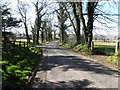
Claragh Road, Cloghog Lower
Heading south
Image: © Kenneth Allen
Taken: 5 Apr 2013
0.06 miles
3
Claragh Road
Heading north at Cloghog Lower
Image: © Kenneth Allen
Taken: 5 Apr 2013
0.10 miles
4
Claragh Road
Heading NNW at Cloghog Lower
Image: © Kenneth Allen
Taken: 5 Apr 2013
0.11 miles
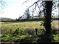
5
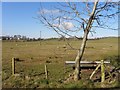
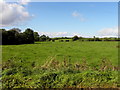
Cloghog Lower
Looking west from Claragh Road
Image: © Kenneth Allen
Taken: 5 Apr 2013
0.16 miles
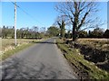
7
Claragh Road, Cloghog Lower
Heading north towards Laght
Image: © Kenneth Allen
Taken: 5 Apr 2013
0.18 miles
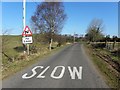
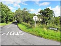
8
Claragh Road
Looking NNW towards the junction with the Gllygooley Road
Image: © Kenneth Allen
Taken: 20 Aug 2009
0.23 miles
9
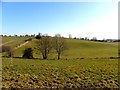
Cloghog Upper
Looking west from Claragh Road
Image: © Kenneth Allen
Taken: 1 Oct 2014
0.23 miles
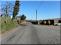
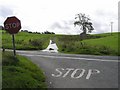
10
Claragh Road, Coolkeeragh
Heading NNW from the Gillygooly Road, a few metres along over the Kilmore Burn is the townland of Cloghog Lower
Image: © Kenneth Allen
Taken: 13 Aug 2012
0.24 miles