IMAGES TAKEN NEAR TO
Dunteige Road, OMAGH, BT78 5PE
Introduction
This page details the photographs taken nearby to Dunteige Road, BT78 5PE by members of the Geograph project.
The Geograph project started in 2005 with the aim of publishing, organising and preserving representative images for every square kilometre of Great Britain, Ireland and the Isle of Man.

There are currently over 7.5m images from over14,400 individuals and you can help contribute to the project by visiting https://www.geograph.org.uk
Image Map
Images are licensed for reuse under creativecommons.org/licenses/by-sa/2.0
Notes
- Clicking on the map will re-center to the selected point.
- The higher the marker number, the further away the image location is from the centre of the postcode.
Image Listing (150 Images Found)
Images are licensed for reuse under creativecommons.org/licenses/by-sa/2.0
Image
Details
Distance
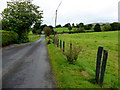
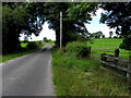
2
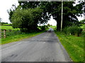
Dunteige Road
Heading west from Lisnacreaght to Glasmullagh
The townlands are separated by a small burn
Image: © Kenneth Allen
Taken: 12 Sep 2017
0.06 miles
3
Dunteige Road
Heading west at Lisnacreaght
Image: © Kenneth Allen
Taken: 1 Aug 2020
0.06 miles
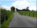
4
Dunteige Road, Lisnacreaght
Heading west to Glasmullagh
Image: © Kenneth Allen
Taken: 4 Apr 2016
0.07 miles
5
Dunteige Road
Heading west from Lisnacreaght towards Glasmullagh
Image: © Kenneth Allen
Taken: 12 Sep 2017
0.07 miles
6
Dunteige Road, Lisnacreaght
Heading west towards Glasmullagh
Image: © Kenneth Allen
Taken: 3 Feb 2023
0.07 miles
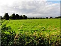
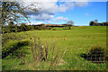
7
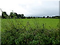
Glasmullagh Townland
Looking south from Dunteige Road
Image: © Kenneth Allen
Taken: 12 Sep 2017
0.07 miles
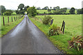
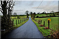
8
Dunteige Road
Heading east at Lisnagreaght
Image: © Kenneth Allen
Taken: 9 Jul 2014
0.07 miles
9
Dunteige Road, Lisnacreaght
Heading west
Image: © Kenneth Allen
Taken: 9 Jul 2014
0.07 miles
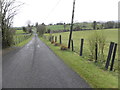
10
Lisnacreaght Townland
Looking north from Dunteige Road
Image: © Kenneth Allen
Taken: 4 Mar 2022
0.08 miles