IMAGES TAKEN NEAR TO
Lisnacreaght Road, OMAGH, BT78 5PD
Introduction
This page details the photographs taken nearby to Lisnacreaght Road, BT78 5PD by members of the Geograph project.
The Geograph project started in 2005 with the aim of publishing, organising and preserving representative images for every square kilometre of Great Britain, Ireland and the Isle of Man.

There are currently over 7.5m images from over14,400 individuals and you can help contribute to the project by visiting https://www.geograph.org.uk
Image Map
Images are licensed for reuse under creativecommons.org/licenses/by-sa/2.0
Notes
- Clicking on the map will re-center to the selected point.
- The higher the marker number, the further away the image location is from the centre of the postcode.
Image Listing (59 Images Found)
Images are licensed for reuse under creativecommons.org/licenses/by-sa/2.0
Image
Details
Distance
1
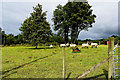
Sheep grazing, Lisnacreaght
Pictured along Lisnacreaght Road
Image: © Kenneth Allen
Taken: 1 Aug 2020
0.08 miles
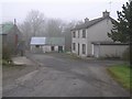
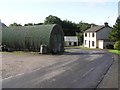
2
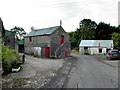
Farm buildings, Lisnacreaght
Pictured along Lisnacreaght Road
Image: © Kenneth Allen
Taken: 15 Aug 2012
0.09 miles
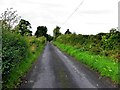
3
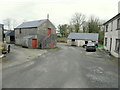
Farm buildings along Lisnacreaght Road
Heading south
Image: © Kenneth Allen
Taken: 4 Apr 2016
0.09 miles
4
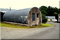
Nissen hut, Lisnacreaght
Pictured along Lisnacreaght Road
Image: © Kenneth Allen
Taken: 31 Jul 2019
0.10 miles
6
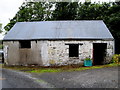
Farm outbuilding, Lisnacreaght
Located along Lisnacreaght Road
Image: © Kenneth Allen
Taken: 14 Aug 2018
0.10 miles
7
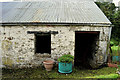
Out building, Lisnacreaght
Pictured along Lisnacreaght Road
Image: © Kenneth Allen
Taken: 1 Aug 2020
0.10 miles
9
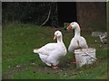
The guardians of Lisnacreaght
Goose and gander on patrol
Image: © Kenneth Allen
Taken: 19 Feb 2008
0.10 miles
10
Farm buildings, Lisnacreaght
Heading south
Image: © Kenneth Allen
Taken: 20 Aug 2009
0.11 miles